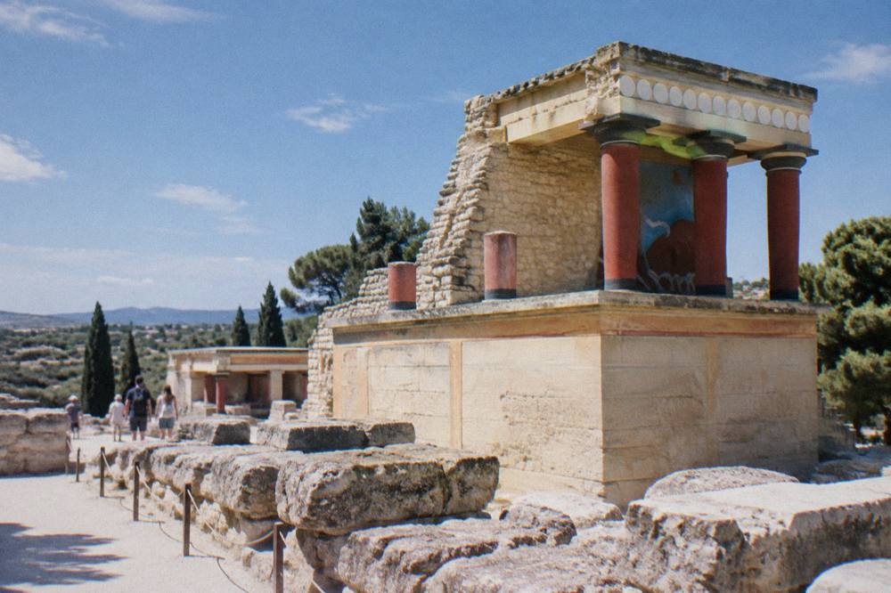
Map Of Crete Chania
Chania is a coastal city on the north-west coast of Crete, Greece, and almost everything a visitor plans, from the Old Town to Balos, Elafonisi and the gorges, makes sense once the map is read correctly.
Short answer
Chania sits on the north-west coast of Crete, facing the Aegean (Cretan) Sea, with the White Mountains to the south and Souda Bay to the east. The airport is about 14 km away, the Piraeus ferry leaves from Souda port, and the big beach and gorge day trips all run west or south from the city.
Chania is a coastal city on the north-west coast of Crete, Greece, on the Aegean (Cretan) Sea, and reading its position on the island's map explains nearly every decision a trip involves. The city has 111,375 permanent residents in its municipality (2021 census), which covers 356.12 km2, and its Old Town wraps around a Venetian Harbour first built between 1320 and 1356. To the south rise the White Mountains (Lefka Ori), to the east lies Souda Bay, and beyond the mountains the south coast opens onto the Libyan Sea, where boats to Gavdos leave from Paleochora and Sougia in season. This guide walks the map outward from the harbour: the Old Town streets, the airport and ferry connections, the beaches and gorges within day-trip range, and the climate table that decides when each of them is pleasant. For a broader view of what the city offers, start with the site's things to do in Chania overview.
Where Is Chania On A Map Of Crete?
Chania occupies the north-west corner of Crete, on the coast that faces the Cretan Sea, with its historic centre around a Venetian Harbour and its municipality covering 356.12 km2 of the surrounding shore and inland villages. The White Mountains sit to the south of the city, Souda Bay indents the coast to the east, and the whole island's road network reaches the city from Heraklion and Rethymno to the east and Kissamos to the west.
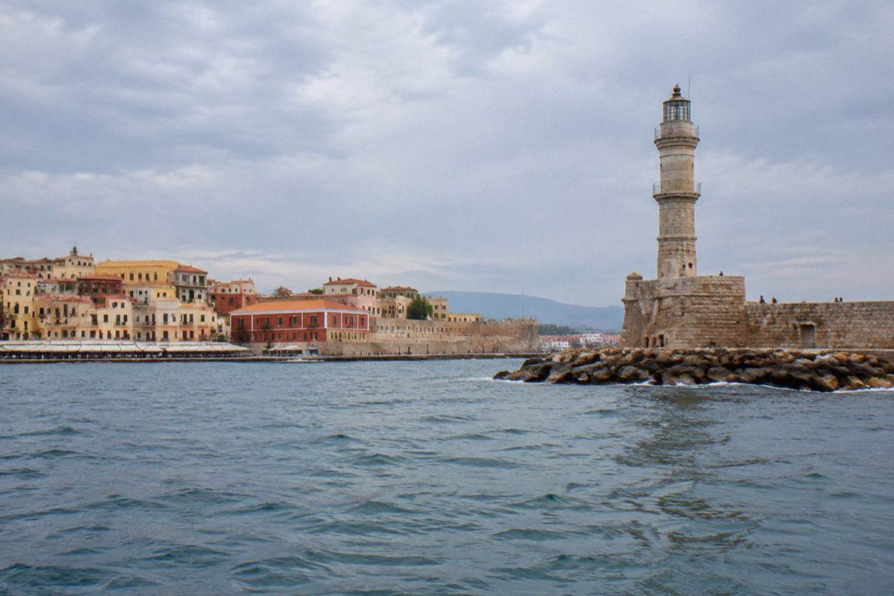
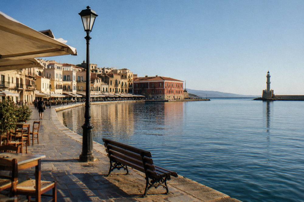
The city's geography is unusually legible on a map. The Old Town clusters on a small peninsula where the Venetian Harbour was first built between 1320 and 1356, with dredging and a wall recorded in 1515. The lighthouse (Faros) stands on the harbour mole: a Venetian structure of about 1595 to 1601, restored on its Venetian base during Egyptian rule between 1830 and 1840 and operating from 1839. East of the Old Town, about 7 km along the coast, lies Souda port, where the overnight Blue Star Ferries service to Piraeus departs at about 21:30 with a crossing of about 9 hours 15 minutes per the operator's published timetable.
South of the city the terrain changes fast. The White Mountains (Lefka Ori) dominate the regional map, and the gorges that cut through them, Samaria and Imbros among them, run north to south toward the Libyan Sea. This is why so many day trips from Chania are described by direction rather than distance: the roads from the city to the south coast cross the mountains, and the island has no railway at all, so every journey is by road or by boat.
How Do The Main Places On The Map Connect To Chania?
Chania connects to the rest of Crete by three arteries: the long-distance KTEL buses from the station on Kydonias street, the airport at CHQ about 14 km from the centre, and the Souda to Piraeus ferry, with Blue Star Ferries running the overnight crossing of about 9 hours 15 minutes. Heraklion, Rethymno, Kissamos, Paleochora and Omalos are the names that anchor the map's road network, and the KTEL route list names them all.
The KTEL bus network is the island's public backbone from Chania. The long-distance station sits on Kydonias street, and the published routes reach Heraklion and Rethymno eastward, Kissamos westward, Paleochora and Omalos southward, and, in summer, Elafonisi directly. No fare or timetable figure belongs on this page: those live on the operator's own booking channels, and getting around Chania and the KTEL Chania buses guide cover them in detail.
| Connection | How it works on the map | What is verified |
|---|---|---|
| Chania Airport (CHQ) to the city | Airport on the Akrotiri peninsula near Souda, about 14 km from the centre | Public bus and taxi information sits on the airport's own site |
| Souda port to Piraeus | Overnight Blue Star Ferries departure about 21:30, crossing about 9 h 15 min | Operator's published timetable, to be confirmed before travel |
| Chania to Heraklion and Rethymno | KTEL long-distance routes from Kydonias street station | Route list per KTEL Chanion |
| Chania to Kissamos | KTEL route west along the coast | Route list per KTEL Chanion |
| Chania to Omalos and Paleochora | KTEL routes south toward the mountains and the south coast | Route list per KTEL Chanion |
| Chania to Elafonisi | KTEL seasonal summer route | Route list per KTEL Chanion |
The airport deserves its own paragraph because it is the one map fact that is wrong everywhere. Chania International Airport "Ioannis Daskalogiannis" is about 14 km from the city centre, on the Akrotiri peninsula near Souda. The Chania airport guide and the airport to Chania town page cover arrivals, and flights to Chania covers routes. For drivers, Chania car rental, airport car rental and the driving in Crete guide continue the map onto the road.
Food is also part of the map: the island's olive groves, vineyards and mountain villages sit within an hour or two of the city, and tasting them is half the reason to leave the harbour. A cooking class in a White Mountains village is the related pick for this page, and Check availability shows the operator's current dates. The Cretan food in Chania and Chania restaurants guides map the city's own tables.
What Does A Map Of Chania Old Town Show?
A map of the Old Town shows a compact peninsula organised around the Venetian Harbour, with the lighthouse on its mole, Firka Fortress at the harbour's north-west edge built in 1620, seven surviving Neoria shipyards of an original seventeen along the quay, and the districts of Topanas, Splantzia and Halepa fanning out from it. The whole core is walkable, and the Archaeological Museum sits away from it in Halepa at 15 Skra Street.
The harbour is the map's anchor point. First built between 1320 and 1356, it gained a recorded wall and dredging in 1515, and its shipyards, the Neoria, survive today as seven structures of an original seventeen from the 15th to 16th century. The Venetian Harbour guide and the lighthouse of Chania page walk the mole itself, while Firka Fortress, built in 1620 with free grounds, guards the harbour mouth.
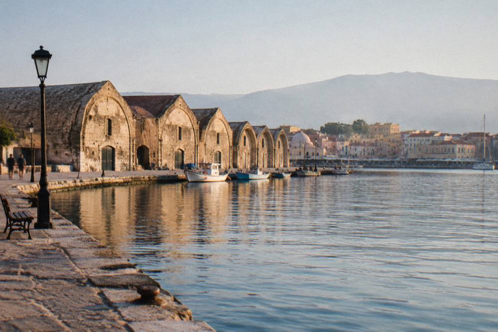
The districts read like rings around that anchor. Topanas and Splantzia flank the harbour west and east, the Old Town guide covers the whole core, and Halepa sits to the east toward the sea: it holds the Archaeological Museum of Chania at 15 Skra Street, whose full ticket is EUR 15 with an EUR 8 concession, and whose visit page should be checked for current hours. The city's history layers are visible on any good plan: first Venetian walls from 1336 to about 1356, second walls from 1536 on Michele Sanmicheli's design, Ottoman rule from the 1645 conquest, and the union of Crete with Greece in 1913.
| Old Town map feature | What the map shows | Verified detail |
|---|---|---|
| Venetian Harbour | Central inlet with a mole | First built 1320 to 1356; wall and dredging recorded 1515 |
| Lighthouse (Faros) | Structure on the harbour mole | Built about 1595 to 1601; restored 1830 to 1840, operating 1839 |
| Neoria shipyards | Arched sheds along the quay | Seven survivors of an original seventeen, 15th to 16th century |
| Firka Fortress | Fort at the harbour mouth | Built 1620; grounds free to enter |
| Archaeological Museum | Site in Halepa, east of the core | 15 Skra Street; EUR 15 full, EUR 8 concession |
| City walls | Traces ringing the older core | First walls 1336 to about 1356; second walls from 1536, Sanmicheli design |
Which Beaches And Gorges Sit Within Day-Trip Range?
The day-trip map from Chania runs in two directions: west along the coast to Balos Lagoon and Gramvousa by boat from Kissamos, Falassarna and Elafonisi by road, and south through the White Mountains to the Samaria and Imbros gorges, which end on the Libyan Sea coast at Agia Roumeli and Chora Sfakion. Every one of these is a day trip, not a city sight, and each carries its own access caveat.
To drive any of those routes on your own schedule, book a rental car here.
Balos Lagoon and Gramvousa sit at the north-west tip of the map. Boats leave from Kissamos port, with daily departures running to 31 October 2026 per the operator, and the only confirmed charge is a EUR 1 Kissamos municipal fee collected on the boat ticket for over-13s. A proposed time-slot visitor cap of about 1,200 visitors per three hours was announced in August 2026 but is not in force, so no cap should be assumed. By land, the route runs along an unpaved road from Kaliviani to a parking area, then a walk down. The Balos Lagoon and Gramvousa guide maps it fully.
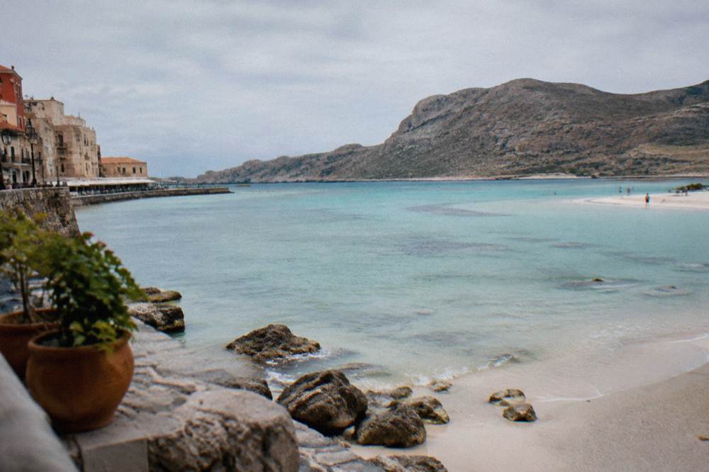
Elafonisi lies on the south-western corner of the island: a Natura 2000 protected area where entry is reported to be free and taking sand, shells or plants is prohibited. A summer KTEL route reaches it directly, and guided road trips run year-round options. The Elafonisi beach and Elafonisi vs Balos pages compare the two western headliners, and the best beaches in Chania guide maps the rest of the coast.
Samaria Gorge is the south-running line on the map: a one-way walk from Xyloskalo on the Omalos plateau down to Agia Roumeli, with boats from Agia Roumeli to Sougia or Chora Sfakion at about 17:30 and a KTEL bus back, as reported. The gorge normally opens 1 May to 31 October, but storms in late September and early October 2026 destroyed sections of the path, staff describe a 2026 reopening as extremely difficult with works aimed at readiness in May 2027, and no final decision is on record: the NECCA status must be checked before any plan. The ticket is EUR 10 through the NECCA e-ticket portal, free for EU residents under 18 and over 65, entry for the full walk runs 07:00 to 13:00, everyone is out by 18:00, and neither swimming nor camping is allowed in the park. Tour prices for the gorge exclude the separate entrance and ferry charges. The Samaria Gorge and Imbros Gorge guides carry the detail.
| Day trip on the map | Direction from Chania | Access as verified |
|---|---|---|
| Balos and Gramvousa | North-west, by boat from Kissamos | Daily departures to 31 Oct 2026 per operator; EUR 1 municipal fee on the ticket for over-13s |
| Elafonisi | South-west, by road or seasonal KTEL bus | Natura 2000 area; entry reported free; no sand, shells or plants may be taken |
| Falassarna | West, by road | Covered in the site's Falassarna guide |
| Samaria Gorge | South through the White Mountains | Normally 1 May to 31 Oct; storm-damaged in 2026, check NECCA status; EUR 10 ticket via the e-ticket portal |
| Imbros Gorge | South, parallel to Samaria | Covered in the site's Imbros guide |
| Rethymno, Heraklion and Knossos | East along the north coast | KTEL routes to both cities; the site's Rethymno and Heraklion guides map them |
How Does The Weather Table Read Month By Month?
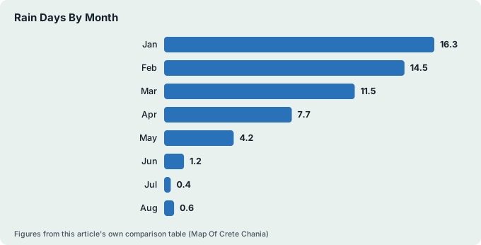
The HNMS Chania Souda station table, covering the period 1958 to 2010 at 148 m inland of Souda Bay, shows a Mediterranean pattern: July and August are the warmest months at 26.7 C and 26.3 C mean with 1.0 and 1.4 mm of rain, January is the wettest month at 129.5 mm, and rain starts to matter again from October, when 67.7 mm falls. May to September is the dry window.
The full table is worth reading before dates are fixed. Humidity in the same station records runs from 50 percent in July to 73 percent in January, and the prevailing wind is west, turning north-west in July and August. No monthly sea-temperature normal exists for this coast, so none is printed; a live reading is a live reading only. The Chania weather and best time to visit Chania guides translate the same table into season-by-season advice.
| Month | Mean C | Mean max C | Mean min C | Rain mm | Rain days |
|---|---|---|---|---|---|
| Jan | 11.0 | 14.4 | 7.9 | 129.5 | 16.3 |
| Feb | 11.0 | 14.7 | 7.8 | 104.0 | 14.5 |
| Mar | 12.7 | 16.6 | 9.0 | 76.0 | 11.5 |
| Apr | 15.9 | 20.0 | 11.4 | 31.5 | 7.7 |
| May | 20.2 | 24.5 | 15.0 | 13.5 | 4.2 |
| Jun | 24.7 | 28.9 | 19.0 | 3.4 | 1.2 |
| Jul | 26.7 | 30.7 | 21.2 | 1.0 | 0.4 |
| Aug | 26.3 | 30.4 | 21.2 | 1.4 | 0.6 |
| Sep | 23.2 | 27.4 | 18.7 | 15.4 | 3.2 |
| Oct | 19.4 | 23.5 | 15.7 | 67.7 | 9.3 |
| Nov | 15.8 | 19.6 | 12.4 | 77.0 | 11.2 |
| Dec | 12.7 | 16.2 | 9.7 | 101.9 | 16.1 |
Read as a planning tool, the table says three things. June, July and August are almost rain-free, with July recording 0.4 rain days on average across the station period. The shoulder months of May and September sit at 13.5 mm and 15.4 mm respectively, which is why they suit hikers: the gorge season normally opens 1 May and closes 31 October. And from October onward the rain figures climb steeply, 67.7 mm then 77.0 mm then 101.9 mm, which matters for anyone mapping a late-autumn trip around mountain roads.
How Do You Use The Map To Plan Days And Nights?
The map supports a simple planning logic: base yourself in or near the Old Town for harbour evenings and restaurants, spend day slots on the western and southern day trips, and match each day's direction to the season, with gorges in the May to June and September dry windows and boat trips in the peak summer months. The how many days in Chania question answers itself once the distances and directions are on paper.
For the base, the where to stay in Chania guide maps the neighbourhoods, with best hotels in Chania and boutique hotels in Chania covering specific searches. One cost note belongs on every booking: accommodation collects a climate crisis resilience fee per room or apartment per night, with seasonal rates, and the amount is confirmed at booking. For arrival logistics, Athens to Chania and the Piraeus to Chania ferry guide map the two main routes in, and Chania parking covers the car once it is here.
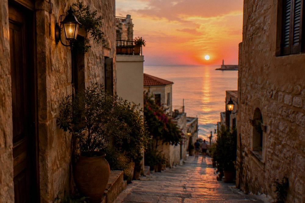
The day-trip calendar then falls out of the map. Balos boats run daily to 31 October 2026 per the operator's listing. Elafonisi has a direct seasonal bus in summer plus year-round guided road options. The gorges are strictly seasonal, and Samaria's 2026 status in particular must be checked on the NECCA channel before any booking, as storm damage has closed or delayed it. Eastward, Rethymno, Heraklion and Knossos are KTEL or tour-bus days, and the site's best tours from Chania page collects the directions in one place.
| Trip idea on the map | Best season per the station table | The caveat to check |
|---|---|---|
| Old Town and harbour walking | Any month; July mean 26.7 C, January mean 11.0 C | Museum hours on the museum's own visit page |
| Balos and Gramvousa by boat | Summer to 31 Oct 2026 per operator | Departure dates on the operator's listing |
| Elafonisi by road | May to September dry window | Seasonal KTEL route times |
| Samaria Gorge | Normally 1 May to 31 Oct | NECCA status after 2026 storm damage |
| Rethymno and Knossos eastward | Any month | KTEL long-distance schedule |
| South coast villages and Gavdos boats | Season only | Boats from Paleochora and Sougia run in season |
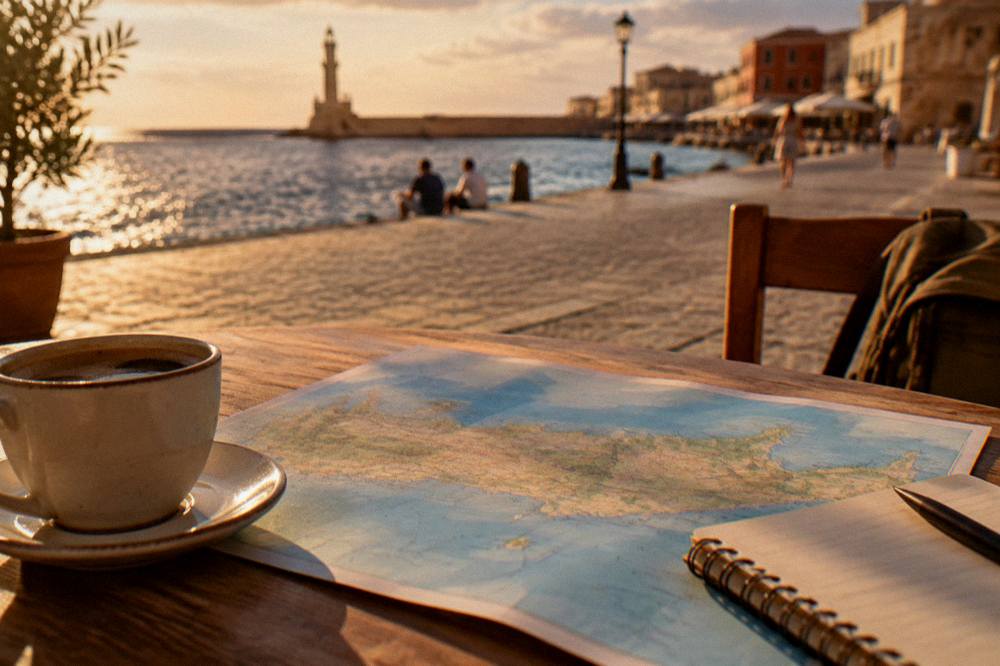
Common Questions About The Map Of Crete And Chania
Is Chania on the coast of Crete?
Yes. Chania is a coastal city on the north-west coast of Crete, facing the Cretan Sea, with its Old Town around the Venetian Harbour and the White Mountains to the south.
How far is Chania Airport from the city?
Chania International Airport "Ioannis Daskalogiannis" (CHQ) is about 14 km from the city centre, on the Akrotiri peninsula near Souda. Public bus and taxi information is published on the airport's own site.
Where does the ferry to Athens leave from?
From Souda port, about 7 km east of the Old Town, not from the Venetian Harbour. Blue Star Ferries runs the overnight crossing to Piraeus, departing about 21:30 with a crossing of about 9 hours 15 minutes per the operator's timetable, to be confirmed before travel.
Which day trips can you make from Chania?
Balos Lagoon and Gramvousa by boat from Kissamos, Elafonisi and Falassarna by road, the Samaria and Imbros gorges to the south, and Rethymno, Heraklion and Knossos eastward along the north coast.
Is there a train on Crete?
No. There is no railway on Crete; every journey on the island is by road, by bus or by boat.
What is the wettest month in Chania?
January, with 129.5 mm of rain over 16.3 rain days, in the HNMS Chania Souda station table for 1958 to 2010. July is the driest month in the same table at 1.0 mm.
Read this way, the map stops being decoration and becomes the plan itself: a walkable harbour core, an airport 14 km out, a ferry port 7 km east, mountains to the south and the island's headline beaches and gorges arranged around the city in every direction that matters. The Chania Crete Travel Guide covers each of those directions in its own page, and the tables above are the verified numbers to plan against.