Driving In Crete
Driving in Crete from a Chania base is about three decisions: which roads to take, which trips are better by boat, and what to confirm at the rental desk before the keys change hands.
Short answer
Driving in Crete from Chania works well for the west: the airport sits about 14 km from the centre, the national road runs east to Rethymno and Heraklion, and Balos, Elafonisi and Samaria all start from this corner of the island. The catches are the unpaved stretch to Balos, storm closures at Samaria Gorge, and a climate that turns wet from October.
Driving in Crete, when the trip is based in Chania on the island's north-west coast, is really a question about geography rather than technique. The city sits between the White Mountains to the south and the Aegean's Cretan Sea to the north, and every famous destination in western Crete, Balos, Elafonisi, Samaria, Falassarna, sits at the end of a road that leaves from somewhere near here. Some of those roads are wide national-road tarmac. One of them, the track to Balos, is unpaved and finishes on foot. This guide lays out which is which, using the figures the airport, the bus operator, the park agency and the meteorological service actually publish.
Is Driving In Crete A Good Idea From A Chania Base?
Yes, for the west of the island a car is genuinely useful, because Chania sits at the neck of every major western route: the national road runs east from here toward Rethymno and Heraklion, regional roads thread south to the gorges and the Libyan Sea coast, and the airport is about 14 km from the city centre on the Akrotiri peninsula. The KTEL bus network covers Heraklion, Rethymno, Kissamos, Paleochora, Omalos and, in summer, Elafonisi, but it does not reach every beach, and there is no railway on Crete.
That last point matters more than visitors expect. On the mainland a train can absorb part of a long itinerary; here the choice is car, bus or boat, and nothing else. The bus station on Kydonias street is the hub for all long-distance routes, with tickets bookable at e-ktel.com, so a mixed plan, car for two days and buses for the rest, is entirely workable.
The desk's honest framing is this: driving earns its keep on the days you want to leave early, stop at a viewpoint, or reach a beach the timetable ignores. On the days you go to Balos by boat from Kissamos or hike Samaria with a transfer, a hired car can sit unused in a parking space while the trip itself runs on a coach. The full getting around Chania overview compares every mode, and the KTEL bus routes from Chania page carries the network detail.
| Driving fact | Value | Source detail |
|---|---|---|
| Airport to Chania centre | About 14 km | Airport's own site, Akrotiri peninsula near Souda |
| Piraeus ferry port | Souda, about 7 km east of the Old Town | Operator's route page |
| Long-distance bus station | Kydonias street, Chania | KTEL Chanion |
| Railway on Crete | None | No rail network exists on the island |
| Currency | Euro | Greece in the euro area since 1 January 2001 |
| Border system | Schengen; EES fully deployed 10 April 2026 | Greece abolished internal checks 26 March 2000 |
What Are The Main Driving Routes Out Of Chania?
Three corridors matter: the national road east toward Rethymno and Heraklion, the western road to Kissamos that feeds Balos and Falassarna, and the southern roads that climb over or around the White Mountains toward Omalos, Samaria's starting plateau, and the Libyan Sea coast. Chania's airport connects to the city by public KTEL bus and taxi, with both described on the airport's own site, and the ferry terminal at Souda sits about 7 km east of the Old Town, so arrival logistics touch the road plan from the first hour.
Eastbound is the easy half. Rethymno and Heraklion are both on the KTEL intercity network from Kydonias street, which means the car is optional for both; the Knossos Palace and Heraklion day trip runs on the same corridor. The comparison pages on Chania versus Rethymno and Chania versus Heraklion cover how those cities differ once you arrive.
Westbound is where driving comes into its own. Kissamos is a KTEL destination too, but the boat cruises to Balos and Gramvousa leave from Kissamos port, and the timings of the crossings, daily departures running to 31 October 2026 on the operator's schedule, do not always sit neatly against a bus timetable. The related cruise option, the From Kissamos Port: Boat Cruise to Balos Lagoon & Gramvousa, starts from the port itself, Check availability if skipping the drive appeals. The full guide to Balos Lagoon and Gramvousa covers the boat side.
Southbound is the dramatic half. The road to the Omalos plateau, where Samaria's Xyloskalo entrance sits, climbs into the White Mountains, and the roads onward to Chora Sfakion and the south coast drop back down to the Libyan Sea. These are mountain roads with switchbacks and, on the desert-dry summer surface, loose gravel at the edges. Nothing in the verified sources gives a drive time for any of these routes, so none is printed here; the honest planning number is that a south-coast day from Chania is a full day whatever the wheels.
What Should You Check When Renting A Car In Chania?
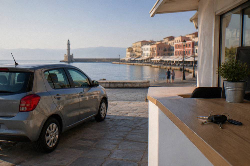
Three checks before the keys change hands: the fuel and damage policy in writing on the agreement, the insurance excess and what a card deposit covers, and the delivery point, since the airport is about 14 km from the centre on the Akrotiri peninsula and a city-centre desk and an airport desk are different logistics on day one. No verified rental rate or deposit figure appears in the sources this site reports, so treat any quote as something to read on the contract itself.
The desk's reporting position on rates is deliberately blank: hire pricing moves with season and demand. What can be stated is structural. Car hire desks serve both the airport and the city, the dedicated pages on car rental in Chania and airport car rental in Chania lay out the options, and the transfer question, airport to town, has its own guide at Chania airport to town.
Rural roads are where rental arguments happen. The unpaved section from Kaliviani toward the Balos parking area is the famous one: an unmade track, then a walk down to the lagoon. A rental agreement that looks cheap can become expensive if the contract excludes damage from unpaved roads, and the wording to look for is any clause about off-road or unsealed surfaces. Ask the desk directly whether the Balos track is covered, and get the answer in writing if it matters to the itinerary.
Age, licence validity and additional-driver terms all sit in the same category: real, variable, and unstated in any verified source. Confirm each at booking. The one thing that can be said with certainty is that Greece has used the euro since 1 January 2001, so any quote will be in EUR, and that accommodation across the island collects a climate crisis resilience fee per room per night at seasonal rates, an amount to confirm at booking rather than in a search result.
Can You Drive To Balos Lagoon From Chania?
Yes, but the drive is only part of the trip: the road from Chania runs west toward Kissamos and the village of Kaliviani, where tarmac gives way to an unpaved road to a parking area, and from there the lagoon is reached on foot by walking down.
The only confirmed charge is a EUR 1 Kissamos municipal fee collected on the boat ticket for over-13s, so drivers using the land route should confirm locally what applies, and no time-slot visitor cap is in force despite an August 2026 proposal.
That proposal, roughly 1,200 visitors per three hours, was floated in August 2026 and never enacted, so no cap should be planned around. What should be planned around is the track itself. It is unsealed, it is rough, and rental agreements vary on whether it is permitted; the guide to Balos Lagoon and Gramvousa covers the walk and the geography in full.
The alternative is the boat. Cruises leave Kissamos port daily to 31 October 2026 on the operator's published schedule, which makes the boat both the smoother arrival and the one that sidesteps the track question entirely. For travellers staying in Rethymno as well as Chania, a pickup version exists: the Chania/Rethymno: Balos & Gramvousa With Pickup & Boat Ticket option folds the transfer into the day. Check availability to see the pickup points.
| Balos and Gramvousa access fact | Verified value |
|---|---|
| Confirmed fee | EUR 1 Kissamos municipal fee, on the boat ticket, over-13s |
| Boat season 2026 | Daily departures to 31 October 2026 |
| Departure port | Kissamos |
| Land route | Tarmac to Kaliviani, then unpaved road to a parking area, then a walk down |
| Visitor cap | None in force; a time-slot proposal of August 2026 was not enacted |
How Do You Drive To Elafonisi From Chania?
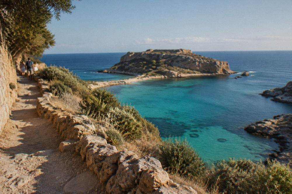
Elafonisi sits on Crete's south-west corner, reached from Chania by roads that run either over the top of the island's western hills or around them through Kissamos and the coast, and in summer a KTEL bus route runs all the way there, one of the few beaches the network serves directly. Entry is reported to be free, the site is a Natura 2000 protected area, and taking sand, shells or plants is prohibited, which is the rule that matters most at a beach famous for its coloured sand.
The two-route structure is the interesting part. One road cuts south through the hills, narrow and winding; the longer one swings west then south. No verified drive time exists for either in the sources this site reports, so the honest answer is that both are half-day-plus journeys from Chania and the choice between them is about comfort with mountain driving rather than minutes saved. The Elafonisi beach guide covers the beach itself, and the comparison page on Elafonisi versus Balos helps with the either-or decision.
The prohibition rule deserves a sentence of its own. Elafonisi's protected status means the sand stays where it is, and that applies to the pink-tinged grains as much as to shells and plants. Parking arrangements at the far end are a confirm-on-arrival matter; no verified parking tariff appears on this page.
Guided options exist for travellers who would rather not drive the western roads at all, combining Elafonisi with Falassarna and tastings; the Elafonisi Pink Beach & Elos & Honey & Wine Tasting tour is one such day out from Chania, and the best tours from Chania page ranks the full field.
Is Samaria Gorge A Driving Trip Or Not?
Not really: the standard Samaria day runs one-way on foot from Xyloskalo on the Omalos plateau down to Agia Roumeli, where boats leave about 17:30 for Sougia or Chora Sfakion, and a KTEL bus closes the loop to Chania, so the car is the awkward piece.
The gorge normally opens 1 May to 31 October, but storms in late September and early October 2026 destroyed sections of the path, no reopening decision is on record, and works target May 2027, so the NECCA status page is the only authority.
The ticket is EUR 10 through the NECCA e-ticket portal, free for EU residents under 18 and over 65. Reported park rules: entry for the full walk between 07:00 and 13:00, everyone out by 18:00, no swimming and no camping in the park. No daily visitor cap is on record.
| Samaria Gorge fact | Verified value |
|---|---|
| Normal season | 1 May to 31 October, dates can change with circumstances |
| 2026 status | Storm damage in late September and early October; no reopening decision on record |
| Works target | Readiness for May 2027, per the agency |
| Ticket | EUR 10 individual, NECCA e-ticket portal |
| Free entry | EU residents under 18 and over 65 |
| Entry window | 07:00 to 13:00 for the full walk; all out by 18:00 |
| Park rules | No swimming, no camping |
| Exit boats | From Agia Roumeli about 17:30, to Sougia or Chora Sfakion, then KTEL bus |
Because the logistics are a walk, a boat and a bus, the guided versions do the driving instead: the Full-Day Samaria Gorge Trek Excursion & Guide from Chania handles the transfers, with the separate entrance and ferry charges excluded from the tour price. Check availability and confirm the gorge's status on the NECCA page before committing to a date.
The status caveat is not boilerplate. A gorge that closes after storms is a gorge that reopens on the agency's schedule, not the calendar's, and the same storms can affect mountain roads south of Chania. The dedicated explainer on why the Samaria Gorge closes goes through the mechanics.
What Are Mountain Roads In The White Mountains Like To Drive?
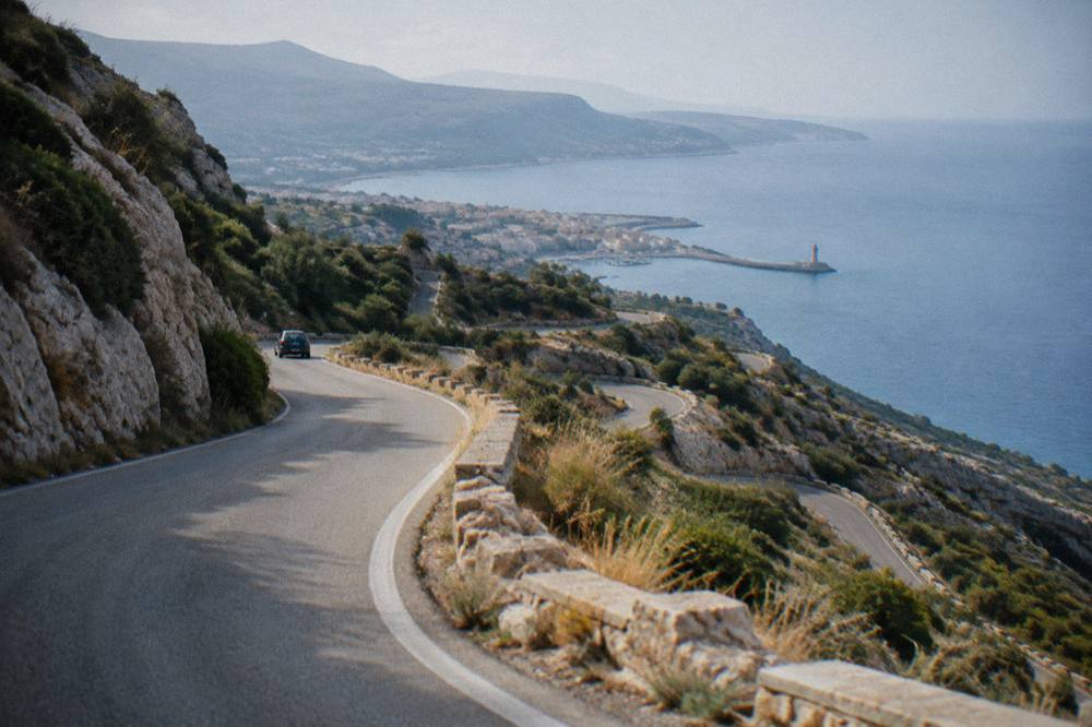
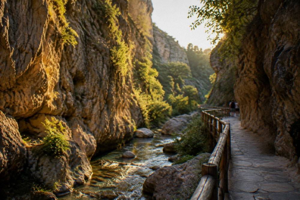
Mountain roads south of Chania are narrow, winding and serious: they climb from the coastal plain into the White Mountains to reach the Omalos plateau, Samaria's trailhead, and then fall again toward the Libyan Sea ports such as Chora Sfakion, with hairpin sections, unlit stretches and drops at the edge. The KTEL network runs buses to Omalos and Paleochora from the Kydonias street station, which tells you these roads are driveable and serviced, and also that a professional driver is available if the switchbacks do not appeal.
The desk's reporting on these roads stays structural because no verified gradient, exposure or surface detail exists in the sources. What can be said is what the geography and the bus network jointly imply: passable, mapped, served, and demanding full attention. Practical rules that apply anywhere apply doubly here: no stopping on blind bends, fuel topped up before the climb, and a plan that reaches the destination in daylight, because nothing in the sources describes night lighting on any mountain road.
Meltemi deserves a mention under this heading too. A north-westerly wind pattern runs through summer, and on exposed high sections it pushes a light car around. The meteorological detail lives in the next section; the driving consequence is simply that a windy day on a plateau road is a day for slower speeds.
For travellers who want the mountains without the mountain driving, two guided forms exist: a White Mountains Land Rover safari from Chania, and a guided Imbros Gorge hike with a village visit, Imbros being the second gorge of the region and a gentler one. The hiking in west Crete guide covers both gorges for walkers.
If you would rather skip the mountain driving, book a White Mountains safari here.
When Does Weather Affect Driving Around Chania?
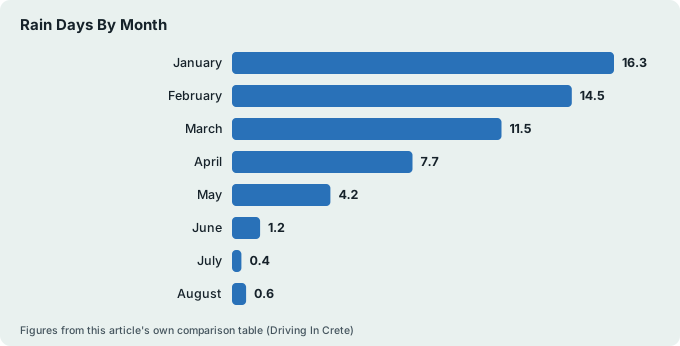
From May to September the weather barely interferes: rainfall on the HNMS Chania Souda station table, which records the period 1958 to 2010, falls to 1.0 mm in July and 1.4 mm in August, with rain days at 0.4 and 0.6, while from October the picture turns, 67.7 mm across 9.3 rain days in October rising to 129.5 mm across 16.3 days in January, the table's wettest month.
Storms in this season closed Samaria's path in 2026, so autumn and winter plans need a forecast check.
The station sits at 148 m inland of Souda Bay, so the table describes the airport-side plain rather than the mountain tops, where conditions run harsher. Mean temperatures show the pattern plainly: 20.2 C in May, 26.7 C in July, 23.2 C in September, then 19.4 C in October and 11.0 C by January. The full breakdown is on the Chania weather page and the best time to visit Chania guide.
| Month | Mean temperature C | Rainfall mm | Rain days |
|---|---|---|---|
| January | 11.0 | 129.5 | 16.3 |
| February | 11.0 | 104.0 | 14.5 |
| March | 12.7 | 76.0 | 11.5 |
| April | 15.9 | 31.5 | 7.7 |
| May | 20.2 | 13.5 | 4.2 |
| June | 24.7 | 3.4 | 1.2 |
| July | 26.7 | 1.0 | 0.4 |
| August | 26.3 | 1.4 | 0.6 |
| September | 23.2 | 15.4 | 3.2 |
| October | 19.4 | 67.7 | 9.3 |
| November | 15.8 | 77.0 | 11.2 |
| December | 12.7 | 101.9 | 16.1 |
The wettest and driest labels apply to this table only. The driving translation is simple: from late October to March, expect rain days on more than half the calendar, check conditions before mountain routes, and treat gorge trips as off the table, since the park's own season ends 31 October in a normal year anyway.
How Does Parking Work In Chania Itself?
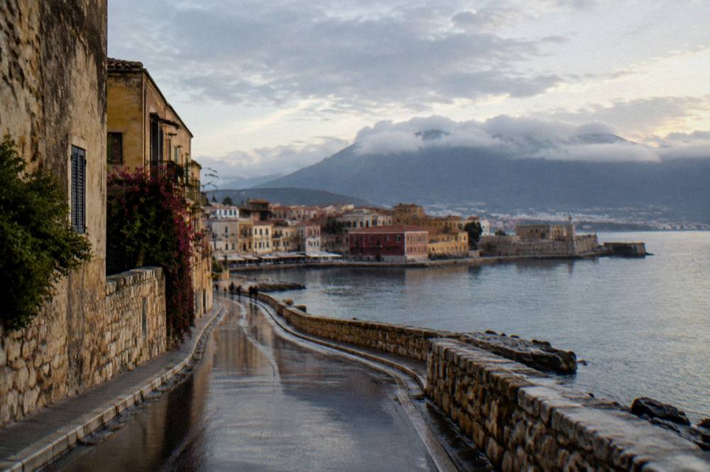
Parking in Chania concentrates around the edges of the Old Town rather than inside it, because the Old Town is a tight web of streets around the Venetian Harbour, first built 1320 to 1356, and the harbour's mole still carries the lighthouse of about 1595 to 1601 with its Egyptian-era restoration of 1830 to 1840; no verified parking tariff exists in the sources this site reports, so the amounts at any car park or meter are a read-the-sign matter on arrival.
What the sources do establish is the geography that makes parking a question at all. The Venetian Harbour serves excursion boats, the Piraeus ferry terminal is 7 km away at Souda, and the Old Town's street pattern predates the car by several centuries, with the first Venetian walls from 1336 and the second from 1536 to Michele Sanmicheli's design. Streets built for that world do not swallow a modern fleet gracefully. The practical detail, where to leave a car and how the zones work, sits on the Chania parking page.
The checks the desk recommends are ones any driver can make directly: the posted tariff at the car park entrance, the time limits on any blue-zone markings, and whether the hotel or rental accommodation includes a space, since accommodation collects the climate crisis resilience fee per room per night at seasonal rates and space is a separate question again, all confirmed at booking.
Drive, Bus Or Ferry: Matching Each Mode To The Trip?
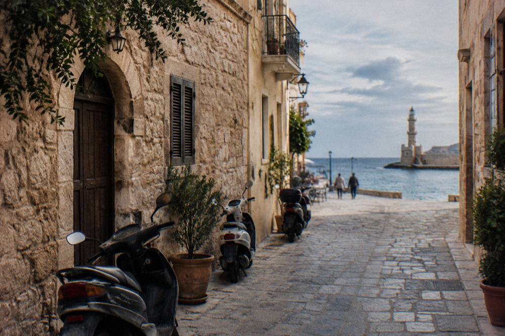
The rule of thumb the sources support: drive for beaches and villages off the bus map, use the KTEL network for the cities it serves directly, Heraklion, Rethymno, Kissamos, Paleochora and Omalos, take the boat for Balos from Kissamos port, and reserve the Souda to Piraeus ferry, departing about 21:30 with a crossing of about 9 h 15 min, for the Athens leg. Each mode has a job it does better than the others, and the mistakes come from forcing one mode onto every trip.
| Trip from Chania | Best-supported mode | Why |
|---|---|---|
| Balos and Gramvousa | Boat from Kissamos port | Daily departures to 31 Oct 2026; skips the unpaved road |
| Elafonisi | Car or summer KTEL bus | Bus runs in summer; entry reported free, Natura 2000 rules apply |
| Samaria Gorge | Guided transfer or bus to Omalos | One-way walk, exit by boat about 17:30, KTEL return |
| Rethymno or Heraklion | KTEL intercity bus | Direct routes from Kydonias street station |
| Athens | Ferry from Souda, about 21:30 departure | Blue Star Ferries, about 9 h 15 min crossing |
| Old Town itself | On foot | Harbour streets predate the car; parking sits at the edges |
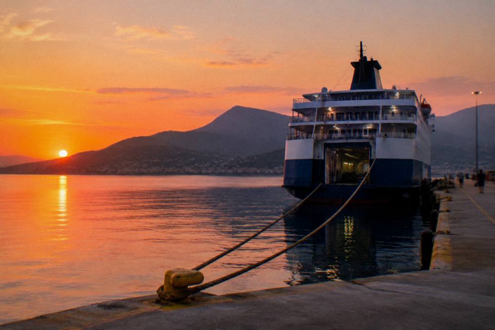
The ferry line deserves its own paragraph because it is the one people get wrong. The Piraeus ferry does not leave from the Venetian Harbour, which is for excursion boats; it leaves from Souda port about 7 km east of the Old Town, and the operator's timetable is the place to confirm the departure before any driving to the terminal is planned. The Piraeus to Chania ferry guide carries the full picture.
For the beach-and-boat combination days, a two-stop option folds Falassarna in with Balos, the Falassarna and Balos cruise with pickup and boat ticket from Chania. Check availability for dates.
Common Questions About Driving In Crete
Is driving in Crete difficult?
The national road east of Chania toward Rethymno and Heraklion is a main route. The mountain roads south toward Omalos and the Libyan Sea coast are narrow and winding, and the track from Kaliviani toward Balos is unpaved. Difficulty depends on which of these the itinerary includes; no route on this page carries a verified drive time.
Which side of the road do you drive on in Crete?
Greece drives on the right, like the rest of the country, and Crete follows the national rule. The sources this site reports cover routes and charges rather than driving law, so licence requirements and local regulations should be confirmed at the rental desk.
Do you need a car in Chania?
Not for the city: the Old Town around the Venetian Harbour is walked, not driven, and parking sits at its edges. A car earns its keep for beaches and villages off the KTEL network, which runs to Heraklion, Rethymno, Kissamos, Paleochora, Omalos and, in summer, Elafonisi from the Kydonias street station.
Can you drive to Balos Lagoon?
Partly. The road runs to Kaliviani, then an unpaved road reaches a parking area, and the lagoon is reached on foot by walking down. The only confirmed charge is the EUR 1 Kissamos municipal fee collected on the boat ticket for over-13s, and drivers should confirm locally what applies at the parking end.
Is the road to Samaria Gorge open?
The gorge normally opens 1 May to 31 October, but storms in late September and early October 2026 destroyed sections of the path and no reopening decision is on record, with works aimed at readiness in May 2027. The NECCA status page is the authority to check before planning the drive to Omalos.
The pattern that runs through every answer on this page is that the Chania Crete Travel Guide desk reports what the operators, the park agency and the meteorological service publish, and leaves the moving numbers, fares, tariffs and rates, to the desk where they are charged. Drive for the west, bus for the cities, boat for Balos, and check the status pages before the mountain days, and driving in Crete from Chania becomes a sequence of small confirmed decisions rather than one long gamble.