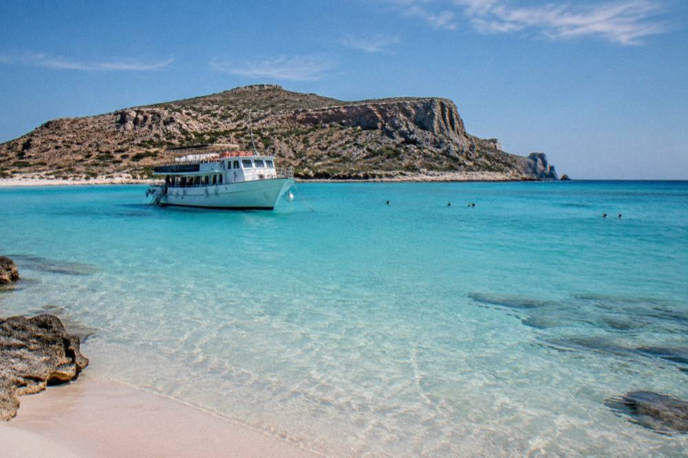
Balos Lagoon
Balos Lagoon sits on the north-west tip of Crete, reached from Kissamos west of Chania by boat or by an unpaved road and a walk. This guide sets out what the operators and the municipality publish, and how to plan the day.
Short answer
Balos Lagoon is a shallow turquoise lagoon on the Gramvousa peninsula in north-west Crete, about a boat ride from Kissamos port west of Chania. The only confirmed charge is a EUR 1 Kissamos municipal fee collected on the boat ticket for over-13s. Boats run daily to 31 October 2026, and the drive-in route uses an unpaved road from Kaliviani followed by a walk down.
Balos Lagoon is the shallow, bright-turquoise lagoon on the north-west tip of Crete, the island whose north coast holds Chania and its Venetian Harbour. It wraps around the Gramvousa peninsula, paired in almost every itinerary with the island of the same name, and it is reached either by boat from Kissamos port or by an unpaved road from the village of Kaliviani followed by a walk down to the sand. This guide lays out what the municipality, the operators and the official climate table actually say, so the day can be planned on published facts rather than on recycled superlatives.
What Is Balos Lagoon And Where Exactly Is It?
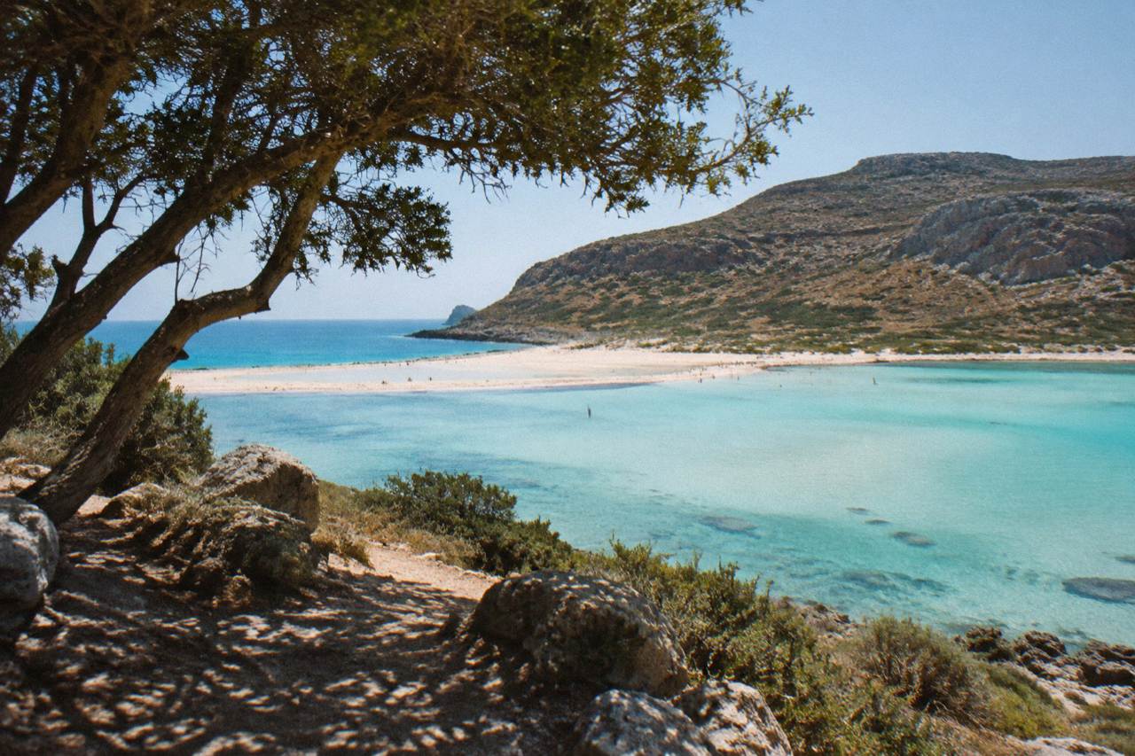
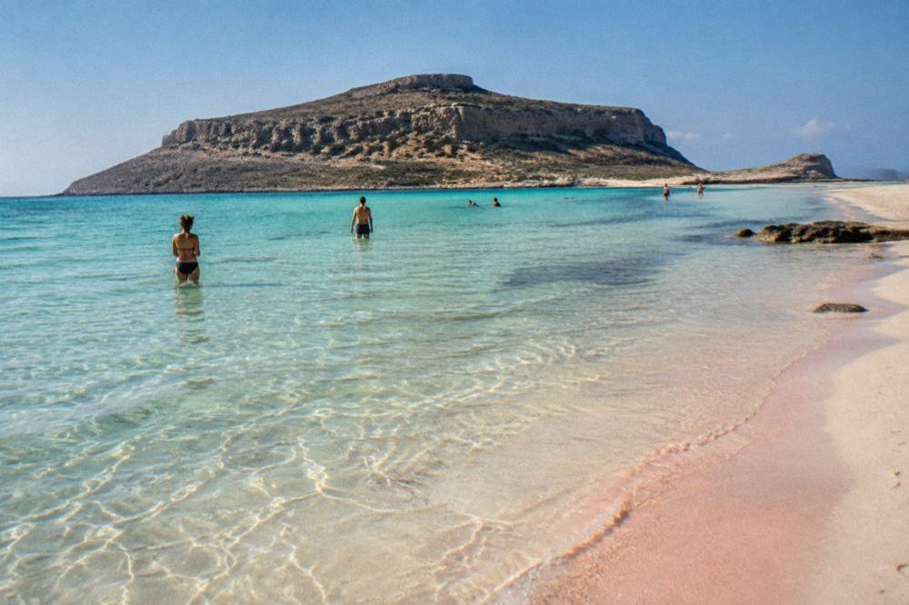
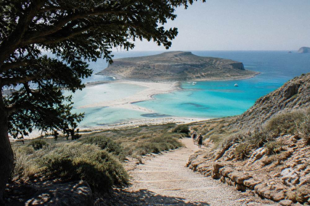
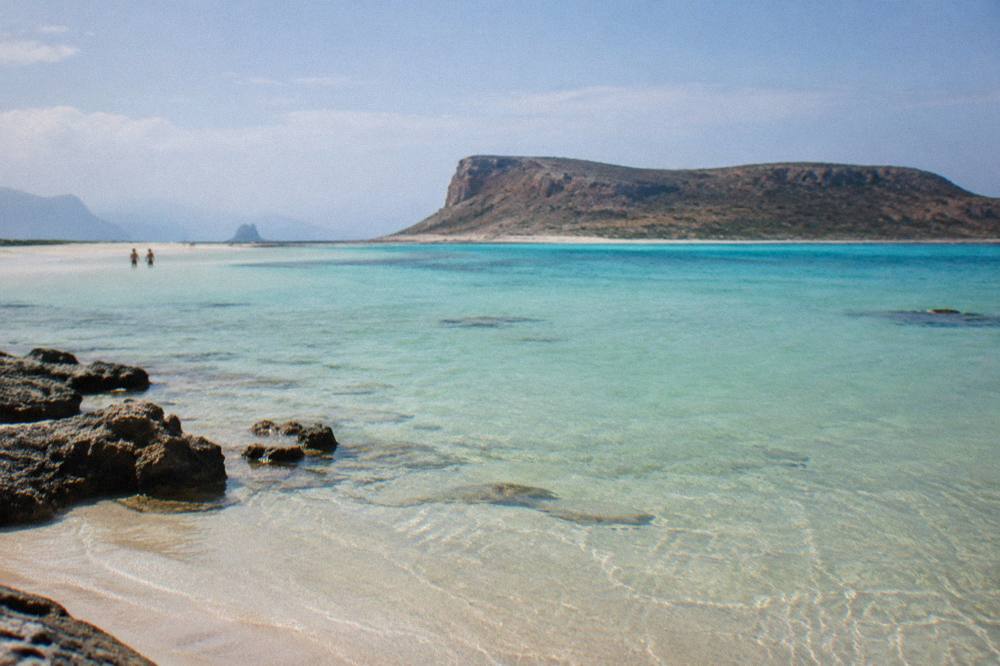
Balos Lagoon is a shallow lagoon on the north-west coast of Crete, on the Gramvousa peninsula west of Chania, where a curved sandy spit shelters warm, pale-blue water between the mainland and the island of Gramvousa. It forms part of the wider peninsula landscape that sits beyond Kissamos, and it is one of the standard day trips from Chania, alongside Elafonisi, Samaria and Falassarna.
The lagoon sits at the foot of the peninsula's western slope, below a headland that drops toward the sea in pale rock. The water inside the spit is shallow and warms quickly, which is the reason for the colour that fills every photograph: light reflecting off a pale sand and shell base through a few dozen centimetres of water. Outside the spit the seabed drops away, and the stretch of open water between the peninsula and the island of Gramvousa is what the excursion boats cross to reach the island stop.
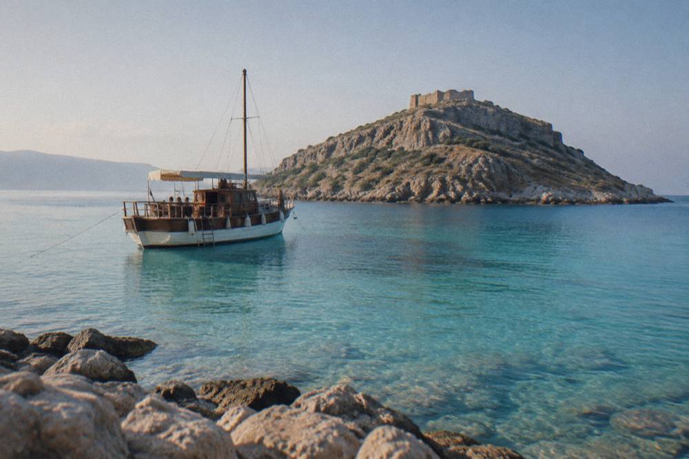
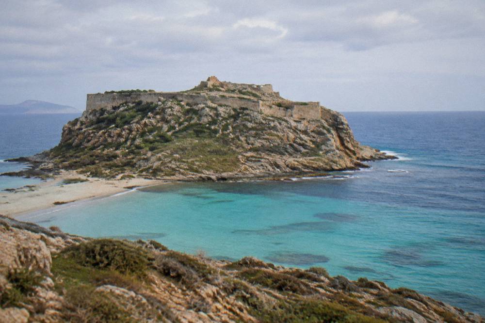
Gramvousa itself is a small island off the tip of the peninsula, and it carries the ruins of a Venetian-era fortress on its summit. The boat itineraries from Kissamos pair the two stops: a climb or a swim at Gramvousa first or second, depending on the operator, and time on the lagoon sand before the return crossing. The Venetian Harbour in Chania, by contrast, is where the short in-city excursion boats leave from, an entirely different thing; Balos boats leave from Kissamos, roughly an hour's drive further west. For how the two beach names stack up against each other, see the site's Elafonisi versus Balos comparison.
How Do You Get To Balos Lagoon From Chania?
From Chania the standard route is west by road to Kissamos port, about an hour along the north coast, and then a booked boat cruise across to the peninsula and the island of Gramvousa. The alternative is to keep driving past Kissamos to Kaliviani and take the unpaved road toward the lagoon parking area, then walk down. There is no ferry from Chania itself.
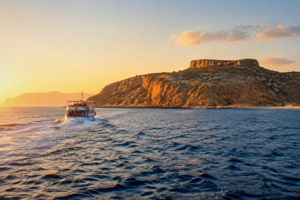
The boat option is the one the bulk of the day-trip infrastructure is built around. Kissamos, a small port town west of Chania, is the departure point for the Balos and Gramvousa cruises, and the operators there run daily departures through the season, with the current schedule published to 31 October 2026 by the operator. The crossing covers the open water between the port and the peninsula, stops at the island, and finishes with time at the lagoon before the return. Pickup versions of the same trip, collected from Chania and Rethymno hotels, also run in season for anyone who would rather not drive to the port at all.
The drive-in option trades the boat for the road. From Chania the route runs west past the turn-offs for Falassarna beach to Kaliviani, the last village on the way out to the peninsula. Beyond the village the road is unpaved to the parking area, and from there a footpath descends to the lagoon. The path is a walk, not a stroll, in summer heat: water and closed shoes matter more than they seem to from the parking area. The site's dedicated answer page covers the practical question in detail at is it difficult to get to Balos beach.
If the road option appeals more than the boat, book a rental car here.
The simplest booked version is the Kissamos boat cruise to Balos and Gramvousa, which puts the crossing, the island stop and the lagoon stop into one ticketed day, and the related tour for this page. If picking the trip up from Chania rather than the port matters, Check availability on the pickup version, which folds the transfer and the boat ticket together.
What Does A Boat Cruise To Balos And Gramvousa Actually Include?
A standard cruise includes the round-trip sailing from Kissamos port, a stop at the island of Gramvousa with time to climb to the fortress or swim, and a stop at the lagoon itself with time on the sand and in the shallow water. Food, drinks and hotel transfers vary by operator and by ticket type, and the details sit on each operator's live listing.
The shape of the day is consistent across the Kissamos operators: board in the morning, cross to the island, spend the middle of the day between the fortress climb and a swim off the island's cove, then reposition to the lagoon anchorage for the afternoon stop before sailing back. What changes between tickets is the layer around that skeleton. Some cruises serve a meal on board, some sell food at the bar, some include the hotel transfer from Chania and some start at the port gangway. The one charge that applies regardless is the EUR 1 municipal fee, which is collected on the boat ticket for over-13s rather than at any gate on the beach.
Two variations on the standard boat are worth naming. A catamaran version runs the same peninsula with meals and drinks built into the day, which suits anyone who wants the sailing itself to be the point rather than the shuttle, and its card sits below. And for a day with no boat at all, the 4x4 option in the trio above drives the unpaved peninsula track from Kissamos in convoy, which answers the road question without handing the reader a rental car on a gravel track.
The table below compares the three main ways the day can be put together. Prices and ratings render on each tour's own page and card, not here; the comparison is about what each way of getting there commits you to.
| Option | Where It Starts | What It Covers | What To Check Before Booking |
|---|---|---|---|
| Cruise from Kissamos | Kissamos port | Boat, Gramvousa stop, lagoon stop | Meal and drink inclusions, departure time |
| Cruise with pickup | Chania or Rethymno hotel | Transfer to Kissamos, boat, both stops | Pickup window, total day length |
| Drive in via Kaliviani | Your own car | Unpaved road, parking, walk down | Vehicle suitability, water for the walk |
Can You Drive To Balos Lagoon, And What Is The Road Like?
Yes, Balos can be reached by road from Chania, but the final stretch from Kaliviani village to the parking area is unpaved, and from the parking area the descent to the lagoon is on foot. The drive is a continuation of the coast road west of Kissamos, and the conditions of the track, not the distance, are what decide whether a rental agreement allows it.
The paved road ends at Kaliviani. What follows is a dirt track across the peninsula's lower slope to a parking area on the headland above the lagoon, and then a footpath that switchbacks down to the sand. Two practical consequences follow. First, many car-hire agreements in Crete exclude unpaved roads, so the contract, not the map, is the thing to read before turning off at Kaliviani; the site's Chania car rental guide covers the general terms.
The jeep-safari format exists precisely because of that track: a convoy of 4x4 vehicles runs from Kissamos with a guide, which puts the unpaved section in the hands of an operator rather than a hire car. For readers weighing that against the boat, the card below is the operator's own listing.
For anyone planning under their own steam, the essentials are water in quantities that feel excessive in the parking area and correct by the bottom of the path, footwear that grips on loose gravel, and a start early enough in the morning that the return climb is not at peak heat. The HNMS Chania Souda station table, 1958 to 2010, puts the July mean maximum at 30.7 C and August at 30.4 C, and there is no shelter on the path.
What Is There To Do On Gramvousa Island?
Gramvousa offers two things: a swim off the island's cove and a walk up to the ruins of the fortress on the summit, which the boats give you a fixed block of time to do. The fortress walls are the visible remnant of the island's fortified past, and the climb, on a rough path with a real gradient, is the reason the boat schedule allocates a stop rather than simply sailing past.
The fortress on the summit is a fortification of the Venetian period, later held and used through the island's turbulent centuries, and its walls stand on the highest point of the island with a view back across the strait to the peninsula and the lagoon. The path to it is uneven rock and loose stone with sustained gradient; the boats give the stop a set window and depart on schedule, so the fortress or the swim is a genuine choice on a hot day, not always both. The cove below the anchorage is where the swimming happens, with deep, clear water off the rocks rather than the shallow warmth of the lagoon.
The pairing of the two stops is what makes the day: Gramvousa gives the panorama and the history, Balos gives the water and the sand. Photographically the summit view of the lagoon's curve is the shot the peninsula is known for, taken from the fortress walls rather than from the beach itself.
| Stop | What The Time Is For | Terrain | Shade |
|---|---|---|---|
| Gramvousa fortress | Summit walk, viewpoint, walls | Rough path, sustained climb | Essentially none |
| Gramvousa cove | Swimming off the rocks | Rocks at entry, deep water | Limited, near the boat |
| Balos lagoon | Sand, shallow warm water | Sand and shell fragments | Very little on the spit |
When Is The Best Time Of Year To Visit Balos Lagoon?
The boat season at Balos runs through the warm months, with Kissamos operators publishing daily departures to 31 October 2026, and the HNMS Chania Souda station table, 1958 to 2010, shows May to September as the dry window, with July and August the warmest and busiest months. Late June or September balances heat, rainfall and cruise frequency without naming a single best week.
The climate table below is the station record the Hellenic National Meteorological Service publishes for Chania Souda, covering 1958 to 2010, and it is the only climate series this site prints. Two patterns matter for a Balos day. Rainfall collapses from May onward, with 13.5 mm in May, 3.4 mm in June and 1.0 mm in July, then climbs again from October, which carries 67.7 mm. And the mean maxima run 30.7 C in July and 30.4 C in August, the two months when the fortress climb and the walk back up from the lagoon are hardest. October still runs a mean maximum of 23.5 C with the boats sailing, which makes the shoulder end of the published schedule a calm, warm option.
| Month | Mean C | Mean Max C | Rain mm | Rain Days |
|---|---|---|---|---|
| May | 20.2 | 24.5 | 13.5 | 4.2 |
| Jun | 24.7 | 28.9 | 3.4 | 1.2 |
| Jul | 26.7 | 30.7 | 1.0 | 0.4 |
| Aug | 26.3 | 30.4 | 1.4 | 0.6 |
| Sep | 23.2 | 27.4 | 15.4 | 3.2 |
| Oct | 19.4 | 23.5 | 67.7 | 9.3 |
Source: HNMS Chania Souda station table, monthly means 1958 to 2010.
Timing within the day matters as much as timing within the year. The boats arrive in blocks, so the lagoon is quietest in the first hour after any boat lands and again in the final hour before departure. Drivers have the opposite lever: an early start from Chania puts the descent ahead of both the heat and the late-morning arrivals.
What Should You Bring For A Day At Balos?
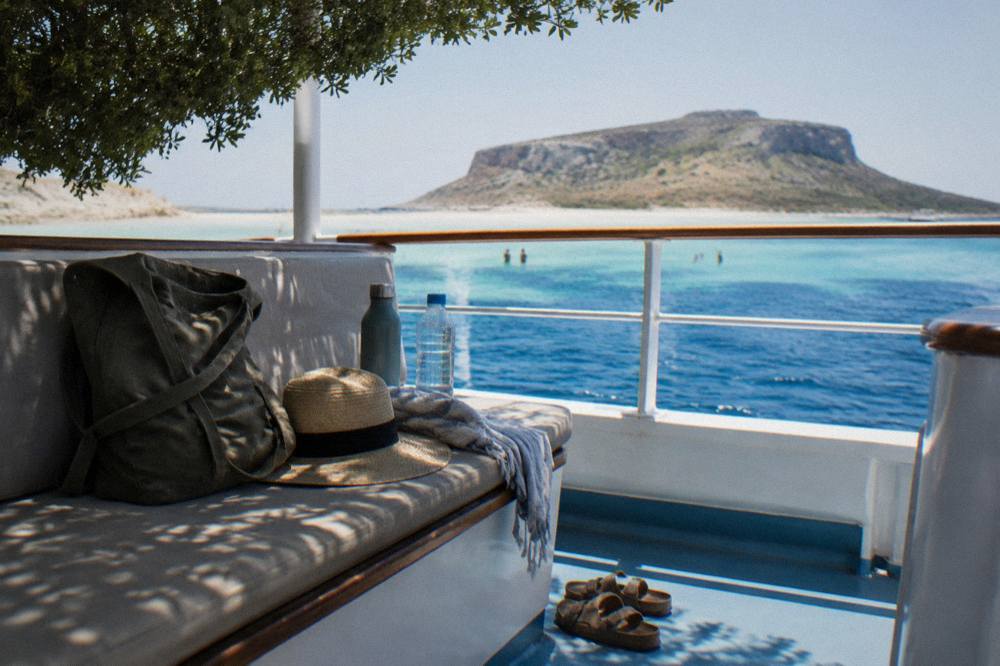
The essentials are more water than seems reasonable, reef-safe sun protection applied before the boat lands, closed shoes for the fortress path or the lagoon descent, and cash for small on-the-spot charges, because the peninsula has no village, no shop and no permanent shade. Whatever a boat serves on board is the only food and drink on the itinerary.
The packing list falls out of the terrain. Wet shoes or sandals that strap on handle both the shell fragments on the spit and the loose stone on the paths. A dry bag does more work than a suitcase of gadgets: it keeps a phone, a hat and a layer dry during the island swim and the boat transfers. And a charged card is not a substitute for a little cash on the north-west coast of Crete, where small canteens and the odd local fee still run on notes and coins.
| Item | Why It Earns Its Place |
|---|---|
| Water, two litres or more per person | The lagoon descent and the fortress path have no water and no shade |
| Closed or strap-on shoes | Loose gravel on both paths, shell fragments on the spit |
| Reef-safe sunscreen, applied early | No shade anywhere on the itinerary |
| Dry bag | Keeps phone and layer dry during swims and boat transfers |
| Cash in small notes | Small charges and canteens on the coast |
| Hat and sunglasses | Reflected light off sand and water all day |
How Does Balos Compare With Elafonisi And Falassarna?
Balos, Elafonisi and Falassarna are the three signature beach day trips west of Chania, and they differ mainly in how they are reached: Balos needs a boat or an unpaved road, Elafonisi is a protected Natura 2000 shore at the end of a long drive, and Falassarna is a broad sandy beach reached on the paved coast road. Each one answers a different kind of day.
Elafonisi, on the south-west corner, is a Natura 2000 protected area with reported free entry, a prohibition on taking sand, shells or plants, and parking reported at around EUR 5 a day; its full profile, including the protection rules, is on the Elafonisi beach guide. Falassarna, closer to Kissamos on the west coast, is the practical sand-and-swim day with the easiest road. Balos is the one that costs effort or a boat, and it is the only one of the three paired with an island fortress stop. Readers torn between the two headliners should start with the Elafonisi versus Balos comparison, and the pairings with the wider region sit in things to do in western Crete from Chania.
| Day Trip | Access | Signature Feature | Main Constraint |
|---|---|---|---|
| Balos and Gramvousa | Boat from Kissamos, or unpaved road plus walk | Turquoise lagoon, island fortress | Effort or boat schedule |
| Elafonisi | Long paved drive from Chania | Protected shallow shore, Natura 2000 rules | Distance; nothing may be taken from the site |
| Falassarna | Paved coast road | Broad sandy beach | Exposure, limited shade |
For a longer west Crete plan, the three can be split across days: Balos and Falassarna share the Kissamos end of the coast road, while Elafonisi pairs naturally with the south-west. Gorge days, such as Samaria Gorge or Imbros Gorge, belong to different footwear entirely.
Planning The Whole Chania Week Around Balos
Balos works best as one anchored day inside a Chania-based week, not as a standalone trip, because it shares its corner of Crete with Falassarna, Gramvousa and the Kissamos coast, and the driving days to Elafonisi and the gorges each consume a full day from the same base. Two or three days in Chania itself, then the west-coast beach day, then a gorge or a south-coast day, is the shape that fits.
The ordering that minimises backtracking runs Chania Old Town and the harbour first, then the Balos-plus-Falassarna west day, then either Elafonisi or a gorge, then Rethymno or Heraklion east if the week stretches that far. The itineraries on this site already carry that logic: the one-day plan keeps Balos out, the two-day plan admits it, and the three-day and five-day plans give it a proper slot alongside a gorge. Boat days are also the ones to lock in first when booking, because the Kissamos operators run a published schedule to 31 October 2026 and the popular sailings fill ahead of the shoulder weekends. The Chania Crete Travel Guide homepage holds the full index of days, beaches and areas.
For a lighter water day with no long drive, the short Lazaretta island trip below runs straight out of Chania's own seafront, which makes it the natural rest-day counterpart to a hard Balos excursion. And if the weather turns, the climate table above says October carries 67.7 mm of rain at the Souda station: the museum and harbour alternatives in Chania in one day are the swap.
Common Questions About Balos Lagoon
Is There An Entry Fee For Balos Lagoon?
The only confirmed charge is a EUR 1 Kissamos municipal fee, collected on the boat ticket for visitors over 13. No other entry fee is confirmed, and a proposed time-slot visitor cap from August 2026 is not in force, so no cap should be treated as a rule.
Can You Get To Balos Without A Boat?
Yes. Drive from Chania west to Kaliviani village past Kissamos, then take the unpaved road to the parking area and walk down to the lagoon. Check the car-hire agreement first, because many exclude unpaved roads, and carry water for the climb back up.
Where Do The Balos Boats Leave From?
From Kissamos port, west of Chania, not from the Venetian Harbour in Chania. The Venetian Harbour serves short in-city excursion boats. Operators publish daily Kissamos departures to 31 October 2026.
Is Balos Suitable For Children?
The lagoon's shallow, warm water suits young swimmers well, but the day involves real sun exposure with almost no shade, and the drive-in option adds a steep walking descent and climb. The boat version, with its fixed shade and seating, is the easier family format; confirm child fares and life-jacket provision at booking.
What Is The Best Month For Balos?
On the HNMS Chania Souda station table, 1958 to 2010, May to September is the dry window, with July and August the warmest at mean maxima of 30.7 C and 30.4 C. June and September balance heat, rain and boat frequency; October sailings still run, with a mean maximum of 23.5 C.
Can You Visit Balos And Elafonisi On The Same Day?
It is possible on paper but rushed in practice, since each sits at the end of a long drive in a different corner of the west. The cleaner plan is one day for Balos and the Kissamos coast, another for Elafonisi, with Falassarna foldable into either.