Venetian Harbour Chania
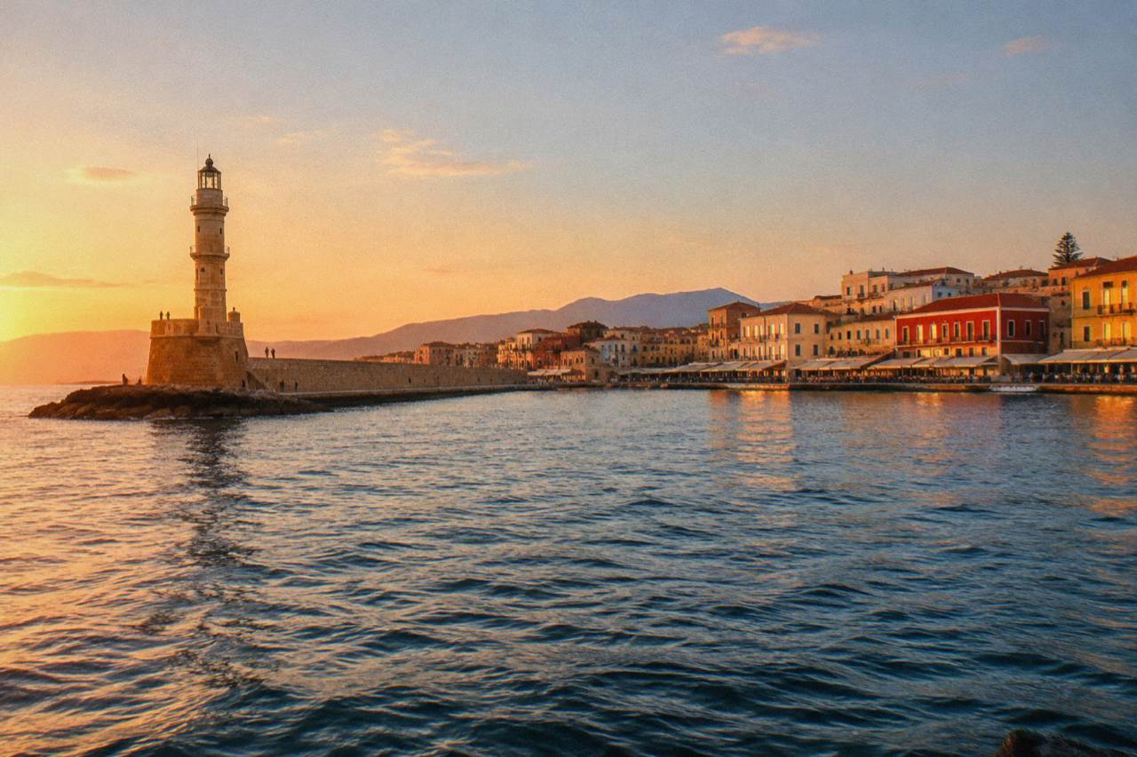
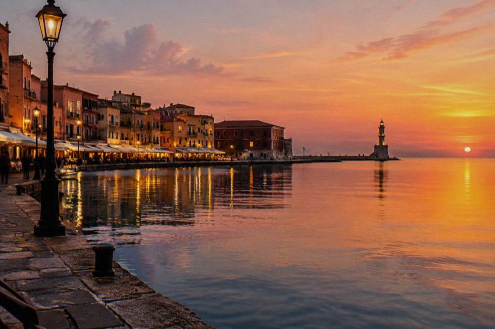
The Venetian Harbour is the heart of Chania on the north-west coast of Crete: a harbour first built between 1320 and 1356, ringed by the lighthouse, Firka Fortress and the Neoria shipyards, and the departure point for excursion boats along the coast.
Short answer
The Venetian Harbour in Chania, Crete, is a harbour first built between 1320 and 1356 on the Aegean Sea whose lighthouse, fortress walls and shipyards survive today. It sits at the edge of the Old Town, about 14 km from the airport and separate from Souda port, and excursion boats leave from its quays.
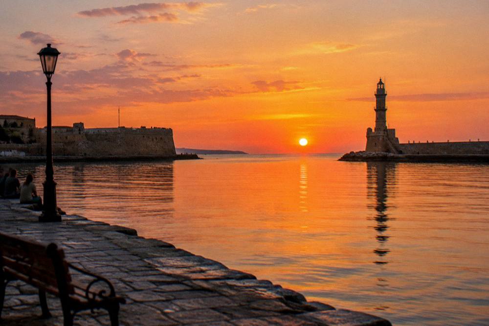
The Venetian Harbour is the reason Chania looks the way it does. The city sits on the north-west coast of Crete, Greece, facing the open sea, and its Old Town curves around this one stretch of water: a harbour first built by the Venetians between 1320 and 1356, later dredged and walled, later still ruled from Constantinople, and finally absorbed into Greece with the rest of Crete in 1913. Today the harbour is a working waterfront rather than a freight port: excursion boats tie up along the quay, the lighthouse stands at the end of the mole, and the lighthouse of Chania, Firka Fortress and the Neoria shipyards together form the most recognisable silhouette in western Crete. This page from the Chania Crete Travel Guide covers what the harbour is, how old its parts are, what sits around it today, which boats leave from it, and how it fits into a wider trip.
What Is The Venetian Harbour In Chania?
The Venetian Harbour in Chania is an artificial harbour on the north-west coast of Crete, first built by Venice between 1320 and 1356, that now forms the waterfront core of the city's Old Town. It is a basin of seawater ringed by quays and historic buildings, with a lighthouse at the end of its mole and the White Mountains rising behind the city to the south. It is not a commercial port and never handles the Piraeus ferries; those leave from Souda port about 7 km east of the Old Town. What leaves from the Venetian Harbour instead are small excursion boats, sunset cruises and trips to nearby spots along the coast.
The harbour works as a single walkable loop. Start anywhere on the quay and the circuit takes in the eastern jetty with its restored buildings, the inner basin where the fishing boats and trip boats moor, the western mole that carries you out towards the lighthouse, and Firka Fortress at the harbour's western mouth, built by the Venetians in 1620. The full loop is flat, paved for almost its entire length, and sits at sea level, which is why so many visitors experience it as a single evening stroll rather than a set of separate sights.
What surprises many first-time visitors is how small the harbour is once you stand inside it. The scale is intimate: a quay you can cross in a minute, a mole you can walk in a quarter of one. The drama comes from the frame, the sea on one side, the stacked fronts of the Old Town on the other, the mountains beyond, and from the density of history packed onto the water's edge, with buildings from the Venetian period standing next to others from the long Ottoman era that began with the conquest of Chania in 1645.
The harbour is also the natural orientation point for everything else in the city. The Old Town spreads south and east from the quays, the Municipal Market sits a short walk inland, and the residential quarter of Halepa, home to the Archaeological Museum of Chania, lies east along the shore. Learn the harbour and you have learned the city's compass.
How Old Is The Venetian Harbour In Chania?
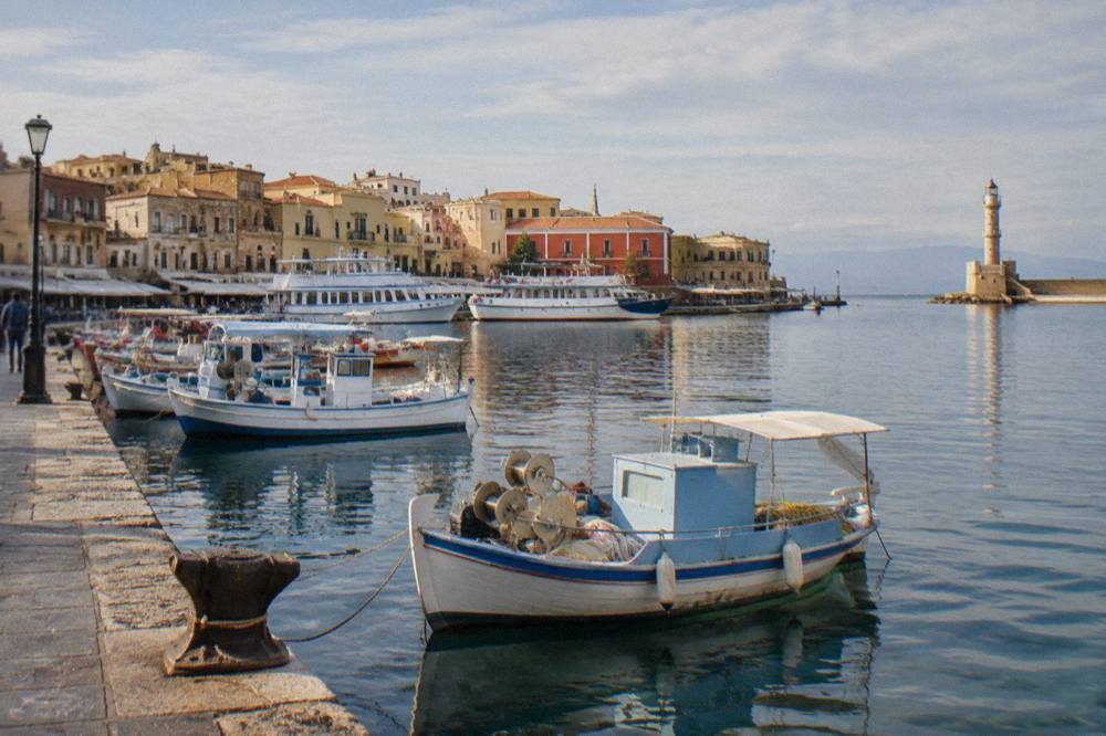
The harbour's first documented life runs from 1320 to 1356, when Venice built the original basin, and the record then shows dredging works and a wall in 1515, first city walls from 1336 to about 1356, and a second, larger wall circuit from 1536 built to Michele Sanmicheli's design. The lighthouse at the mole's end followed about 1595 to 1601, was restored on its Venetian base during the Egyptian rule of 1830 to 1840, and was recorded operating in 1839. Ottoman rule began with the conquest of Chania in 1645 and lasted until Crete's union with Greece in 1913.
That is a lot of dates for one small body of water, so it helps to line them up as a timeline. Each layer left something you can still point at today: the basin itself, the mole, the fortress, the shipyards, the lighthouse, the Ottoman-era waterfront buildings. The harbour you photograph is a composite, and each part carries its own century.
| Date or period | What happened | What you can still see |
|---|---|---|
| 1320 to 1356 | Venice builds the first harbour | The basin and its basic outline |
| 1336 to about 1356 | First Venetian city walls built | Fragments within the Old Town |
| 1515 | Dredging works and a wall recorded | The harbour's maintained depth |
| 1536 onward | Second walls to Michele Sanmicheli's design | Wall remains on the land side |
| About 1595 to 1601 | Lighthouse built on the mole | The lighthouse's Venetian base |
| 15th to 16th century | Neoria shipyards built, seventeen in all | Seven surviving shipyard halls |
| 1620 | Firka Fortress built | The fortress at the harbour mouth |
| 1645 | Ottoman conquest of Chania | Waterfront buildings of the Ottoman era |
| 1830 to 1840 | Lighthouse restored during Egyptian rule | The lighthouse's upper structure |
| 1913 | Union of Crete with Greece | The harbour as a Greek city waterfront |
Two corrections are worth fixing early, because both circulate widely online. First, the lighthouse is often described as simply "Venetian", which is only half true: the base is Venetian, from about 1595 to 1601, while the structure above it dates from the Egyptian-era restoration of 1830 to 1840. Second, the Neoria shipyards are sometimes counted loosely; seven survive of an original seventeen, from the 15th to 16th century, standing in a row at the harbour's eastern end. If you want the longer story of why Venice built here at all, the site's answer page on why Chania is Venetian covers the strategic background.
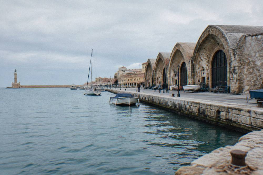
The seven surviving shipyard halls are the harbour's most underrated structures. These long, arched buildings, the Neoria, were built to service and shelter galleys, and their scale gives the clearest sense of what this harbour was for: not pleasure but naval power. Walk their length on the eastern side of the harbour and the geometry of Venetian sea power is still legible in the masonry.
What Can You See Around The Venetian Harbour Today?
A full circuit of the Venetian Harbour in Chania takes in Firka Fortress from 1620 at the western mouth, the lighthouse on the mole, the inner quay with its moored boats, the seven surviving Neoria shipyards at the eastern end, and, a few minutes inland, the Maritime Museum of Crete and the streets of the Old Town. Firka's grounds are free to enter, and the Maritime Museum sits at the fortress's northern edge. The Mosque of the Janissaries stands on the eastern quay, an Ottoman-era building with no verified construction date.
Each of these can absorb a few minutes or an hour, depending on how deeply you go. The table below lists the harbour-side sights with what the record actually verifies about each, so you know what you are looking at and what to confirm on site, opening hours for several of them are not stated in any source this desk holds, so check each venue's own page before planning a fixed schedule.
| Sight | Position on the harbour | What the record verifies |
|---|---|---|
| Lighthouse (Faros) | End of the western mole | Venetian base about 1595 to 1601; restored 1830 to 1840; operating 1839 |
| Firka Fortress | Western mouth of the harbour | Built 1620 by the Venetians; grounds free to enter |
| Maritime Museum of Crete | At Firka Fortress | No verified price or hours; confirm on its own page |
| Neoria shipyards | Eastern end | Seven halls survive of seventeen, 15th to 16th century |
| Mosque of the Janissaries | Eastern quay | Ottoman-era; no verified construction date |
| Inner basin quays | Centre of the harbour | Mooring for fishing boats and excursion vessels |
| Old Town streets | Immediately south of the quays | Built over the Venetian and Ottoman city |
The best approach is to treat the harbour as a spine and branch off it. Walk out the mole towards the lighthouse first, when your legs are fresh, because the return view of the whole waterfront from the mole's end is the single best perspective on the harbour's shape. Then loop back through Firka Fortress, where the Maritime Museum of Crete explains the naval history the shipyards imply, and finish along the eastern quay past the Neoria and the mosque into the Old Town.
If your day has more room, the harbour sits at the centre of a walkable city. The Municipal Market is a few minutes inland, the beach strip of Nea Chora starts west of Firka along the coast, and the whole circuit can be folded into the site's one day in Chania plan or stretched across two days with the museums given proper time. For visitors with a car, further out lie the monasteries of the Akrotiri peninsula and Lake Kournas inland, but the harbour itself needs no vehicle at all.
Where Is The Venetian Harbour And How Do You Reach It?
The Venetian Harbour sits on the coast of Chania on the north-west side of Crete, facing the open sea, at the northern edge of the Old Town, and Chania International Airport is about 14 km away on the Akrotiri peninsula near Souda. The airport's own page carries the current public bus and taxi information for the transfer into the city. The Piraeus ferry does not come here: Blue Star Ferries' overnight service departs Souda port, about 7 km east of the Old Town, at about 21:30 with a crossing of about 9 hours 15 minutes, times to be confirmed against the operator's published timetable.
Distances matter less than you might expect once you arrive, because the harbour is genuinely walkable from almost anywhere a visitor stays in the central city. The table below gathers the verified transport geometry. No fare, tariff or timetable beyond the ferry times stated above appears in any source this desk holds, so each of those must be confirmed at the point of booking or on the operator's page.
| Journey | Distance or detail as verified |
|---|---|
| Airport (CHQ) to city centre | About 14 km, on the Akrotiri peninsula near Souda |
| Souda port to Old Town | About 7 km east of the Old Town |
| Souda to Piraeus ferry | Blue Star Ferries, overnight, departs about 21:30, about 9 h 15 min |
| KTEL long-distance bus station | On Kydonias street, Chania |
| KTEL destinations | Heraklion, Rethymno, Kissamos, Paleochora, Omalos, Elafonisi in summer |
| Venetian Harbour role | Excursion boats only, no ferry traffic |
One mix-up accounts for a steady trickle of missed connections every season: arriving at the Venetian Harbour looking for the Athens ferry. The harbour you see in photographs, with the lighthouse, is purely a waterfront for small boats. Souda, a working port in the bay of the same name, is where the big overnight ships dock, and it is a short bus or taxi hop from there into the Old Town. The airport's own site is the place to confirm current ground-transport options, since fares sit off the record here.
Within the city itself, everything about the harbour is on foot. The Old Town is compact, and the quays, the fortress, the shipyards and the museum quarter of Halepa, where the Archaeological Museum stands at 15 Skra Street with a full ticket of EUR 15 and a concession of EUR 8, chain together into a single walking day. The museum's own visit page should be checked for current opening arrangements before you set a firm schedule.
Which Boat Trips Leave From The Venetian Harbour?
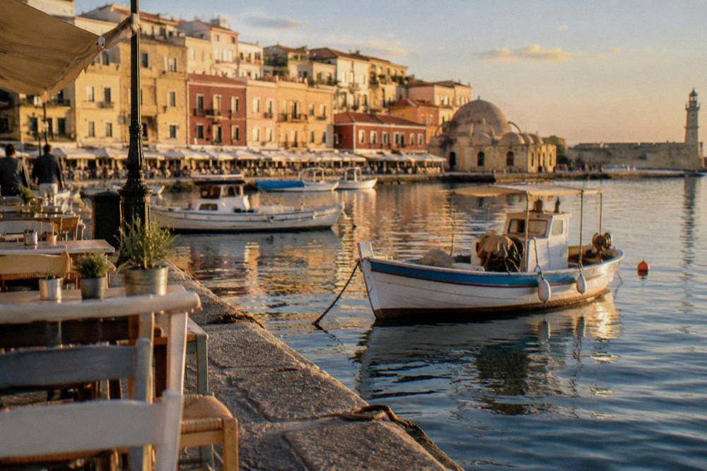
The boats that leave from the Venetian Harbour in Chania are small excursion vessels: short coastal cruises, sunset trips and swim-stop runs to nearby spots such as Lazaretta and Agioi Theodoroi, while the big beach day trips to Balos and Gramvousa depart from Kissamos port to the west, reached by transfer from Chania. The harbour's shallow, intimate basin suits small craft, and the full-day lagoon cruises are built around the western port instead.
For a visitor basing a day around the harbour, the pattern is simple. Book a sunset or coastal cruise and you board steps from the Old Town; book the Balos cruise and a coach carries you to Kissamos, where the ship sails for the lagoon and the island fortress of Gramvousa. The site's full rundown of Chania boat trips covers the wider choice; below is the featured option this desk highlights for the harbour visitor who wants the headline excursion.
The Balos cruise works as a counterpart to a harbour day. Where the Venetian Harbour is stone, history and city, Balos is the shallow lagoon and the island at the end of a boat ride, and the operator's listing shows what the fare covers. Two access notes from the record: the only confirmed charge at Balos is a EUR 1 Kissamos municipal fee collected on the boat ticket for over-13s, and the operator's schedule showed daily departures through to 31 October 2026. Beyond boats, the site also covers hiking in west Crete for the gorge alternative, with the standing caveat that Samaria Gorge normally runs 1 May to 31 October but closes or delays when storms damage the path, so the park authority's status must be checked before any gorge plan is fixed.
What Is The Best Time Of Day To Visit The Venetian Harbour?
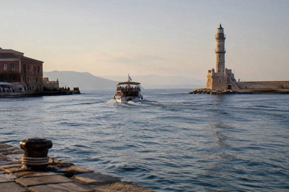
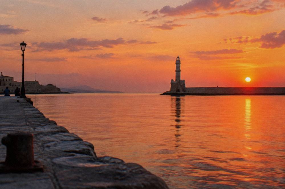
The two natural windows for the Venetian Harbour are the early morning, when the quays are quiet and the light comes from the east across the basin, and the hour before sunset, when the sun drops behind the mole and the lighthouse and the waterfront buildings catch the last light; on the HNMS Chania Souda station record for 1958 to 2010, July and August average 26.7 C and 26.3 C mean temperature with almost no rain, so summer evenings are dependably warm. Midday in high summer is the least comfortable slot, when shade on the open mole is scarce.
The climate record gives a firm basis for timing a visit. The table below shows the station's monthly means; January, at 11.0 C mean and 129.5 mm of rain across 16.3 rain days, is the wettest month in the table, and July, at 1.0 mm, the driest, statements that belong to this station record rather than to any superlative about the city. Rain starts to matter again from October, with 67.7 mm, while May to September is dry, 13.5 mm in May falling to 1.0 mm in July.
| Month | Mean temp C | Mean max C | Rain mm | Rain days |
|---|---|---|---|---|
| Jan | 11.0 | 14.4 | 129.5 | 16.3 |
| Feb | 11.0 | 14.7 | 104.0 | 14.5 |
| Mar | 12.7 | 16.6 | 76.0 | 11.5 |
| Apr | 15.9 | 20.0 | 31.5 | 7.7 |
| May | 20.2 | 24.5 | 13.5 | 4.2 |
| Jun | 24.7 | 28.9 | 3.4 | 1.2 |
| Jul | 26.7 | 30.7 | 1.0 | 0.4 |
| Aug | 26.3 | 30.4 | 1.4 | 0.6 |
| Sep | 23.2 | 27.4 | 15.4 | 3.2 |
| Oct | 19.4 | 23.5 | 67.7 | 9.3 |
| Nov | 15.8 | 19.6 | 77.0 | 11.2 |
| Dec | 12.7 | 16.2 | 101.9 | 16.1 |
A practical rhythm follows from the numbers. From late spring to early autumn, do the exposed parts, the mole walk and the fortress ramparts, either early or in the last two hours of daylight, and keep the middle of the day for the shaded lanes of the Old Town or a museum. In the cooler half of the year, from November to March, the harbour works at any hour the sky is clear, but the rain-day counts, 11 to 16 a month from November to February, argue for keeping a covered option such as the museums in reserve. The site's wider seasonal page on the best time to visit Chania develops this month by month.
How Does The Venetian Harbour Fit Into A Longer Chania Itinerary?
The Venetian Harbour anchors every sensible Chania itinerary because it is the city's orientation point: a one-day visit builds the whole day around the harbour circuit and the Old Town behind it, while two and three day plans add the museums of Halepa, the beaches of the Akrotiri peninsula, and the big day trips west or south, Balos and Gramvousa, Elafonisi, the gorges and the south coast. Nothing on that list needs a guide, but the gorge and lagoon days run far smoother with an organised transfer.
For a single day, the harbour circuit, Firka Fortress, the Maritime Museum and the Old Town lanes fill the time without any transport at all. For a second day, add the Archaeological Museum in Halepa and an afternoon at Nea Chora or one of the peninsula beaches such as Seitan Limania or Marathi. From the third day outward, the day trips take over, and the two flagships are the boat west and the gorge south.
The Samaria trip needs its caveat stated plainly: the gorge normally opens 1 May to 31 October, but storms in late September and early October 2026 destroyed sections of the path, staff called a 2026 reopening extremely difficult, and no final decision was on record when this page was written, so the park authority's status page must be checked before the day is fixed. The individual ticket, EUR 10 through the park's e-ticket portal, is separate from any tour price, and the same separation of entrance and ferry charges applies to the gorge boats from Agia Roumeli. For visitors who want the beach day instead, the transfer-inclusive option below removes the Kissamos drive entirely.
Between the big days, the harbour remains the evening constant. A week built from the site's three day Chania plan still ends each evening on the same quay, because the harbour is the place the day trips return to. Visitors staying longer in the region can push out to Agia Marina and Platanias west of the city, or east to the Akrotiri peninsula monasteries, but the harbour keeps its role as the fixed point of the trip.
Common Questions About The Venetian Harbour In Chania
How old is the Venetian Harbour in Chania?
The harbour was first built between 1320 and 1356, with dredging and a wall recorded in 1515. The lighthouse on the mole dates from about 1595 to 1601 on its Venetian base, restored during Egyptian rule from 1830 to 1840, and Firka Fortress was built in 1620.
Can you walk to the lighthouse in Chania?
Yes, the mole of the Venetian Harbour carries a walk out towards the lighthouse, and the return view of the whole waterfront from the mole is one of the best perspectives on the harbour's shape. The exposed stretch has little shade, so timing follows the season.
Do ferries to Athens leave from the Venetian Harbour?
No. The overnight Blue Star Ferries service to Piraeus departs from Souda port, about 7 km east of the Old Town, at about 21:30 with a crossing of about 9 hours 15 minutes, times to confirm against the operator's timetable. The Venetian Harbour serves excursion boats only.
Is the Venetian Harbour the same as Chania Old Town?
No, but they overlap at the edge. The harbour is the waterfront basin with its mole, lighthouse, fortress and shipyards, and the Old Town spreads south and east of the quays. A harbour circuit leads naturally into the Old Town lanes.
How far is the Venetian Harbour from Chania Airport?
Chania International Airport is about 14 km from the city centre, on the Akrotiri peninsula near Souda. The airport's own page carries current public bus and taxi information for the transfer into the city.
What are the Neoria in Chania?
The Neoria are Venetian shipyard buildings from the 15th to 16th century, built to service galleys. Seventeen were originally constructed and seven survive today, standing in a row at the eastern end of the Venetian Harbour.