Akrotiri Chania
The Akrotiri peninsula sits north-east of Chania on the Aegean coast of Crete, holding the city's airport, working monasteries and a string of coves reachable in under half a day from the Old Town.
Short answer
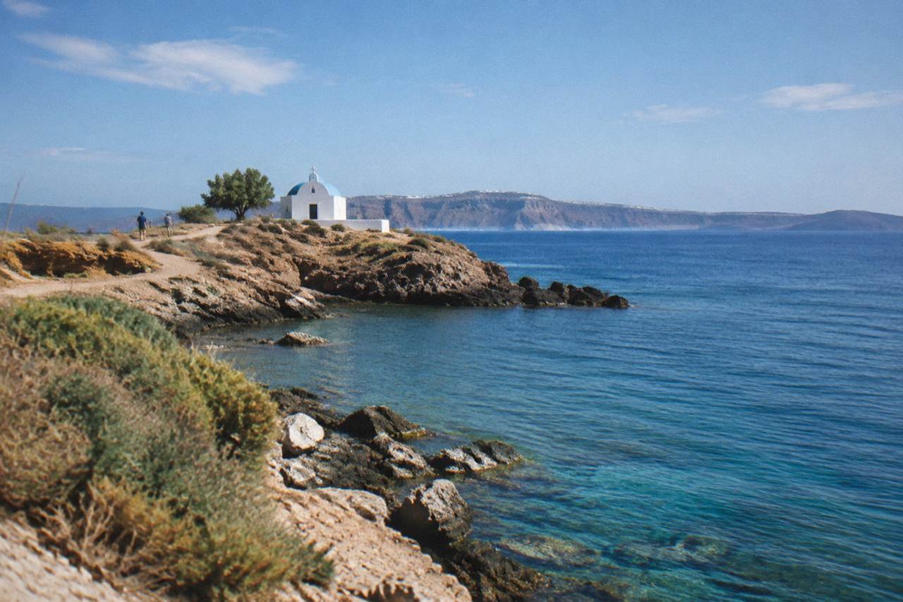
Akrotiri is the peninsula north-east of Chania that carries the airport (CHQ), the monasteries of Agia Triada and Gouverneto, and beaches including Seitan Limania. It works as a half-day loop from the Old Town by hire car or as a slow day of swimming and monasteries.
The Akrotiri peninsula is the broad headland that closes the north-east side of the bay on which Chania sits, on the north-west coast of Crete, Greece, facing the Aegean Sea. The airport that brings almost every visitor into the region sits on it, two working monasteries sit on its rocky spine, and its north shore holds coves that a day-tripper based in the Old Town can reach with a short drive. This page lays out what the peninsula actually contains, what the sources say about each stop, and how the climate table for the Chania Souda station reads across the year.
Where Is The Akrotiri Peninsula In Chania?
The Akrotiri peninsula is the headland north-east of Chania that shelters the city's bay from the open Aegean Sea, and it carries Chania International Airport, the monasteries of Agia Triada and Gouverneto, and the north-shore coves including Seitan Limania. The airport's own page gives its location as the Akrotiri peninsula near Souda, about 14 km from the city centre, a figure repeated in the municipality's own materials. Everything on the peninsula is therefore a short hop from the Old Town rather than an expedition into the interior, and the White Mountains that dominate the view south from Chania sit on the far side of the city, not on Akrotiri itself.
The peninsula's shape matters for planning. It bulges eastward, so its north shore faces the open sea while its south shore faces the calm water of Souda Bay. That split explains the two characters of the place: exposed, dramatic coves on the north side, and quieter, shallower swimming on the south side. The Chania Crete Travel Guide covers the geography of the whole city region, and this page stays on the peninsula itself.
One confusion worth settling early: Souda port, where the overnight Blue Star Ferries service to Piraeus departs, sits at the southern base of the peninsula, about 7 km east of the Old Town. The Venetian Harbour in the centre of Chania serves excursion boats only. If a ferry is part of the itinerary, the Souda area guide handles that side of the peninsula's edge. The municipality of Chania, for the record, counted 111,375 permanent residents at the 2021 census across its 356.12 km2, and the peninsula's villages sit inside that figure rather than apart from it.
What Are The Key Facts About Chania Airport On Akrotiri?
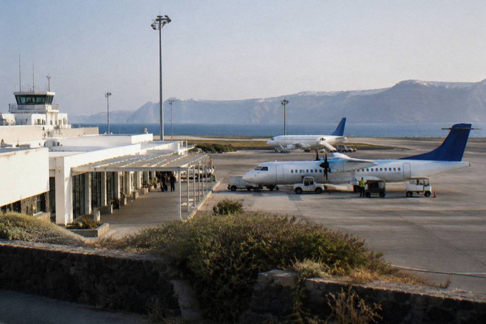
Chania International Airport "Ioannis Daskalogiannis" (CHQ) is the peninsula's single biggest presence, operated by Fraport Greece, about 14 km from the city centre, and it recorded 3,992,149 passengers between January and October 2025, which makes it the entry point for effectively every visit described on this page. Those figures come from the airport operator's own published numbers, and the official pages give the distance as 14 km. Public bus and taxi information for the transfer into the city sits on the airport's own site, and fares are confirmed there or with the driver rather than quoted here.
| Airport fact | Figure as published |
|---|---|
| Official name | Chania International Airport "Ioannis Daskalogiannis" |
| IATA code | CHQ |
| Operator | Fraport Greece |
| Distance from city centre | About 14 km |
| Location | Akrotiri peninsula, near Souda |
| Passengers Jan to Oct 2025 | 3,992,149 |
The airport's position on the peninsula has one practical consequence: a hire car collected at CHQ puts the peninsula's beaches and monasteries within the first hour of a trip, before the Old Town is even checked into. The Chania airport guide and the airport to town transfer page carry the full arrival detail, and the car-rental pages cover the driving side. A traveller landing in the afternoon can realistically see one monastery and one viewpoint before sunset, then start the Old Town proper the next morning.
Greece itself is straightforward at the border for this route. The country has been in the euro area since 1 January 2001 and a full Schengen member with internal checks abolished since 26 March 2000. The Entry Exit System was fully deployed across Schengen on 10 April 2026, and ETIAS is not in operation, with no applications collected as of October 2026.
What Are The Things To Do On The Akrotiri Peninsula Around Chania?
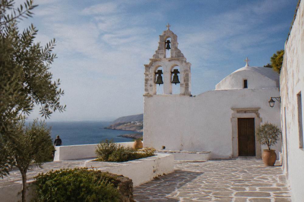
The peninsula's visiting day is built from three monasteries and a run of coves: Agia Triada, Gouverneto and the ruined Katholiko in the interior, then Seitan Limania, Marathi, Kalathas, Stavros and the smaller beaches strung along both shores, and the whole set is drivable as one unhurried loop from the Old Town. Each stop has its own page in this guide's attraction and beach sections, so this page keeps to how they string together. A hire car covers the loop in a morning at a relaxed pace, and the monasteries sit on a single road that runs the peninsula's spine before dropping toward the north-shore coves.
| Stop | What it is | Which page covers it |
|---|---|---|
| Agia Triada monastery | Working monastery, Akrotiri interior | Agia Triada guide |
| Gouverneto monastery | Working monastery, 16th-century walls | Gouverneto guide |
| Seitan Limania | Steep cove on the north shore | Seitan Limania guide |
| Souda port | Ferry terminal to Piraeus | Souda area guide |
| Old Town and harbour | Venetian Harbour, 1320 to 1356 origins | Old Town area guide |
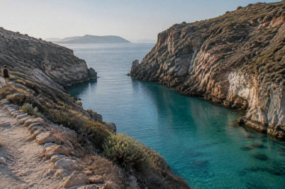
Seitan Limania deserves its warning line. The cove is reached by a steep, stepped goat path, and the reward is a narrow inlet of clear water between high rock walls. The dedicated Seitan Limania page covers the access in detail, including why the descent is not for flip-flops or for anyone unsteady on uneven ground. Stavros, on the peninsula's north-west tip, is the easy-terrain counterweight, with shallow water and a sandy floor, and its own dedicated page describes the setting.
For anyone who prefers a guide to a self-driven loop, the peninsula's calm south-shore water also suits a first paddleboarding session, and a guided day out of the city replaces route-finding with a fixed plan:
When Is The Best Time Of Year For The Akrotiri Peninsula Near Chania?
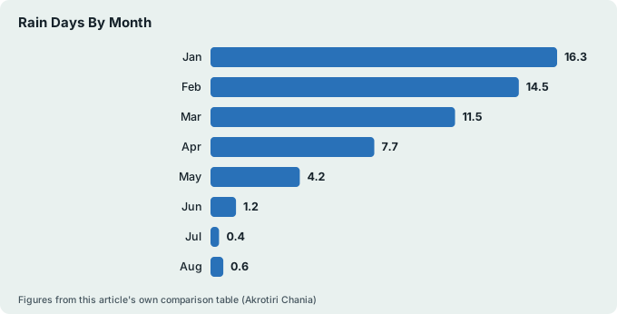
The Chania Souda station table, covering station records from 1958 to 2010, shows the peninsula's visiting window plainly: mean temperatures run from 11.0 C in January to 26.7 C in July, and rainfall collapses from 129.5 mm in January to 1.0 mm in July. The HNMS station sits at 148 m inland of Souda Bay, so it reads slightly inland of the peninsula's shore, but it is the only official series the meteorological service publishes for Chania, and no newer table exists. May to September is effectively dry, with 13.5 mm in May and 15.4 mm in September.
| Month | Mean C | Rain mm | Rain days |
|---|---|---|---|
| Jan | 11.0 | 129.5 | 16.3 |
| Feb | 11.0 | 104.0 | 14.5 |
| Mar | 12.7 | 76.0 | 11.5 |
| Apr | 15.9 | 31.5 | 7.7 |
| May | 20.2 | 13.5 | 4.2 |
| Jun | 24.7 | 3.4 | 1.2 |
| Jul | 26.7 | 1.0 | 0.4 |
| Aug | 26.3 | 1.4 | 0.6 |
| Sep | 23.2 | 15.4 | 3.2 |
| Oct | 19.4 | 67.7 | 9.3 |
| Nov | 15.8 | 77.0 | 11.2 |
| Dec | 12.7 | 101.9 | 16.1 |
Read the table rather than the folklore. January is the wettest month at 129.5 mm and July the driest at 1.0 mm in this series, and rain starts to matter again from October, which carries 67.7 mm. Mean maximums reach 30.7 C in July and 30.4 C in August, while mean minimums sit at 7.9 C in January and 7.8 C in February. Humidity runs from 50 percent in July to 73 percent in January, and the prevailing wind is west, turning north-west in July and August.
What that means for the peninsula specifically is a spring and early-summer advantage. The monasteries' inland road has no shade, and Seitan Limania's descent is a different walk at 30.7 C than at 20.2 C. April and May combine mean temperatures of 15.9 C and 20.2 C with rainfall of 31.5 mm and 13.5 mm, which is why the best time to visit Chania page lands on the same window. The Chania weather page prints the full station table with the daily maximum and minimum columns.
Can You Swim From The Akrotiri Peninsula Beaches Near Chania Old Town?
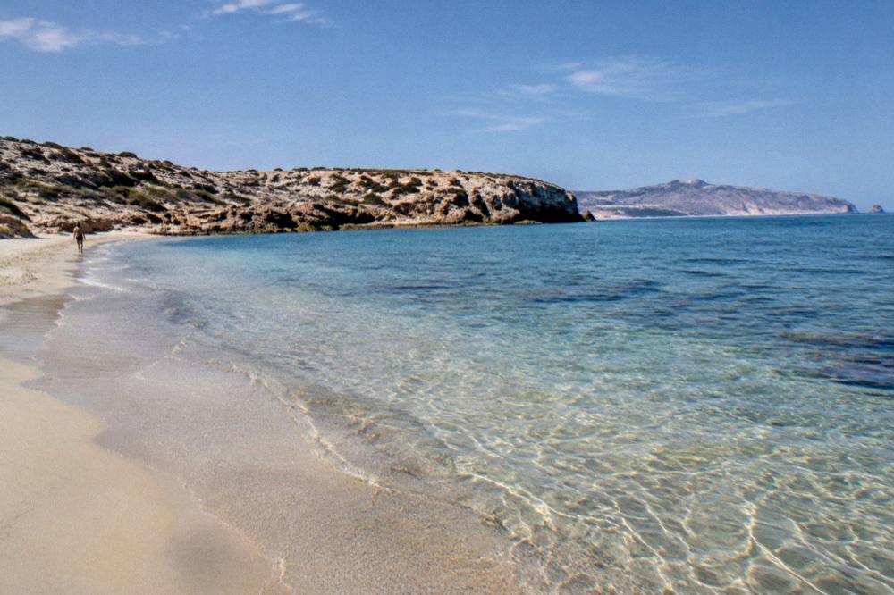
Yes, but not on foot from the Old Town: the peninsula's beaches are a drive or a bus ride from the centre, and the nearest swimming to the Old Town itself sits at Nea Chora on the city side, while Akrotiri holds the peninsula's own coves from Stavros in the west to Seitan Limania on the north shore. The distinction matters because the peninsula looks close on the map, and it is close, but the coves sit behind local roads and, at Seitan Limania, behind that steep path. Nothing on the peninsula is a walk out of the Old Town.
The south shore of the peninsula faces Souda Bay and holds the calmer, shallower water, suited to families and to floating rather than swimming lengths. The north shore takes the open Aegean, and its coves run deeper and colder, with the drama that brings. Both shores appear in the beaches near Chania Old Town rundown, and the peninsula's two characters are the reason that page splits its advice by shore.
For a first-timer who wants the water without the logistics, guided water sessions run from the Chania side of the bay, and a calm-water paddleboard tour suits beginners on the flat south-shore water:
A short boat outing covers the same appetite from a different angle, and the Chania boat trips page compares the harbour departures, including the short Lazaretta Island swim runs that leave from the Old Port.
How Do You Get Around The Akrotiri Peninsula Without A Car In Chania?
A hire car is the practical answer for the peninsula's interior loop, because the monasteries and the north-shore coves are strung along local roads with no single through-route, while the KTEL bus network from the Kydonias street station in Chania serves the peninsula's built-up villages and the airport independently. The bus station's published route list covers Heraklion, Rethymno, Kissamos, Paleochora, Omalos and, in summer, Elafonisi, with airport and peninsula-local services detailed at e-ktel.com, and no fare or timetable is printed here because those are confirmed on the operator's own pages.
For the interior loop on your own schedule, book a rental car here.
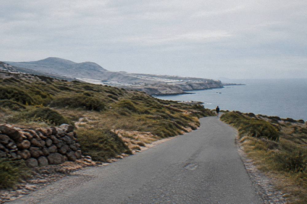
Without a car, the realistic peninsula day is the one a tour operator assembles. The interior monasteries and the coves need wheels, and a guided day trip with pickup folds the driving into a fixed itinerary. The gorge options to the south, Imbros among them, run the same logic: the trailheads sit well beyond walking range of any base, and the return leg from the coast is a bus connection best handled by someone who runs it daily.
The driving itself is covered on the driving in Crete page, including the parking reality in the Old Town, and the getting around Chania page compares the bus network with car hire for the region as a whole. The KTEL buses page adds the route-level detail for anyone planning purely on public transport.
How Does The Akrotiri Peninsula Fit Into A Chania Itinerary?
Akrotiri works as the first morning or the last morning of a Chania stay: collect a hire car at CHQ, run the monastery road and one cove before check-in, or reverse it on departure day, and the peninsula then hands over to the big west-coast day trips, Balos, Elafonisi and Falassarna, and the gorges to the south. The peninsula's stops are short by nature, a monastery courtyard, a viewpoint, a swim, so a half-day fits them without rushing. The Chania one day and Chania two days pages slot Akrotiri into exactly that position.
| Itinerary length | Where Akrotiri sits | Page |
|---|---|---|
| One day | Second half, after the Old Town | Chania one day |
| Two days | Morning of day two | Chania two days |
| Three days | Half-day, paired with a beach day | Chania three days |
| Cruise port day | Usually skipped, the Old Town wins the hours | Cruise port day |
The peninsula also anchors a quieter alternative to the west-coast crowds. Where Balos and Elafonisi need a full day each, the peninsula's coves need an afternoon, which makes it the filler day of a Chania week rather than its headline. The Balos lagoon and Gramvousa and Elafonisi beach pages carry those full-day plans, including the fee details that apply there.
Two fee notes travel with those trips and not with Akrotiri itself. Elafonisi is a Natura 2000 protected area with reported free entry, and taking sand, shells or plants is prohibited. Balos carries only a EUR 1 Kissamos municipal fee collected on the boat ticket for over-13s, and a proposed time-slot cap of about 1,200 visitors per three hours was still a proposal in August 2026, not a rule in force. Boat-ticket prices themselves are confirmed at booking.
What History Is Verified On The Akrotiri Peninsula And Chania?
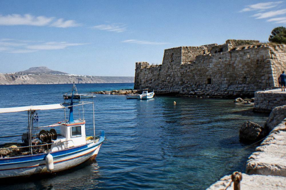
The verified dated record for the peninsula itself is thin and monastic, while the dated monuments visitors photograph sit in Chania: the Venetian Harbour first built 1320 to 1356, the lighthouse of about 1595 to 1601 restored under Egyptian rule from 1830 to 1840, Firka Fortress from 1620, and seven surviving shipyards of an original seventeen from the 15th to 16th century. The city walls run from 1336 and again from 1536 to Michele Sanmicheli's design, Ottoman rule dates from the 1645 conquest of Chania, and Crete's union with Greece came in 1913.
Gouverneto's walls belong to the 16th century as the monastery's own materials describe them, and Katholiko, the ruined monastery in the gorge below Gouverneto, is reached on foot down a rocky path. Beyond those, the peninsula's story is told by its monasteries' own visitor pages rather than by a dated public record, and no construction date is printed here that those pages do not give. The Venetian Harbour and lighthouse pages carry the city-side timeline in full.
Firka Fortress, at the harbour mouth in Chania rather than on Akrotiri, is the free-to-enter counterpoint: its grounds cost nothing and the fort dates from 1620. The Firka Fortress page covers what stands there now, and the Maritime Museum of Crete sits within the same fort, with prices and hours confirmed on the museum's own page. The Archaeological Museum of Chania, over in Halepa at 15 Skra street, charges EUR 15 full and EUR 8 concession, with hours confirmed on its visit page.
Common Questions About The Akrotiri Peninsula In Chania
Is the Akrotiri peninsula the same place as Chania?
No. Akrotiri is the peninsula north-east of Chania, on the Aegean coast of Crete, and it carries the airport, the monasteries and the coves, while Chania is the city at the peninsula's base. The two share a bay and a bus network.
How far is Chania airport from the city centre?
About 14 km, on the Akrotiri peninsula near Souda, according to the airport's own page. Public bus and taxi information for the transfer sits on the airport's site, and fares are confirmed there.
Can you walk to Seitan Limania beach?
You can walk down to it, but not from Chania: the cove is on Akrotiri's north shore and the final descent is a steep, stepped goat path. Sturdy shoes and water are the baseline, and the dedicated Seitan Limania page covers the access in detail.
What is the wettest month on the Chania climate table?
January, at 129.5 mm, in the HNMS Chania Souda station records for 1958 to 2010. July is the driest at 1.0 mm, and rain starts to matter again from October, at 67.7 mm.
Do you need a car for the Akrotiri peninsula?
A hire car is the practical choice for the monastery loop and the north-shore coves. KTEL buses serve the peninsula's villages and the airport, and guided day trips with pickup cover the interior without driving.
Is there an entry fee for the Akrotiri monasteries?
None is published in the sources this guide holds, so the amount, if any, is confirmed at the monastery gate. Firka Fortress in Chania, by contrast, has free grounds.
The peninsula earns its half-day: an airport arrival folded into a monastery morning, a cove swim before the Old Town evening, and a climate table that says May to September is the dry window for both.