Souda Chania Crete
Souda is the working port and broad bay about 7 km east of Chania Old Town in Crete, Greece: the place the Athens ferry leaves from, the neighbour of the airport, and a stretch of coast a lot of visitors pass through without stopping. This guide sets out what the sources actually say about it.
Short answer
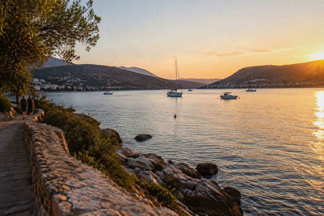
Souda is a port town and wide bay on the Akrotiri side of Chania, about 7 km east of the Old Town. The overnight Blue Star Ferries service to Piraeus departs from Souda port at about 21:30, and Chania International Airport sits on the Akrotiri peninsula nearby, about 14 km from the city centre.
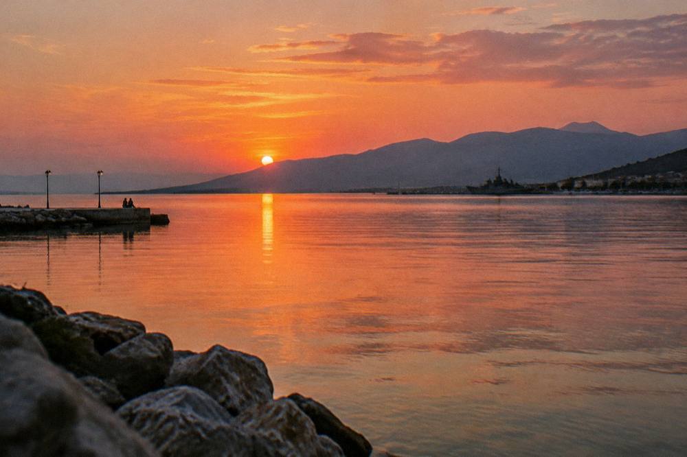
Souda is the port and the bay that shelter the working side of Chania, the coastal city on the north-west coast of Crete, Greece, that faces the Cretan Sea. The Old Town and its Venetian Harbour sit about 7 km to the west; between them and the water of Souda Bay lie residential slopes, naval land and the road that carries ferry traffic to and from Athens. This is not a district of boutique hotels and harbour tavernas in the postcard sense. It is the part of Chania that moves people: the overnight ferry to Piraeus, the naval station, the approach to Chania International Airport on the Akrotiri peninsula, and a long stretch of quiet shoreline that a visitor based here can use as a base or as a half-day detour.
What Is Souda, And Where Does It Sit Within Chania?
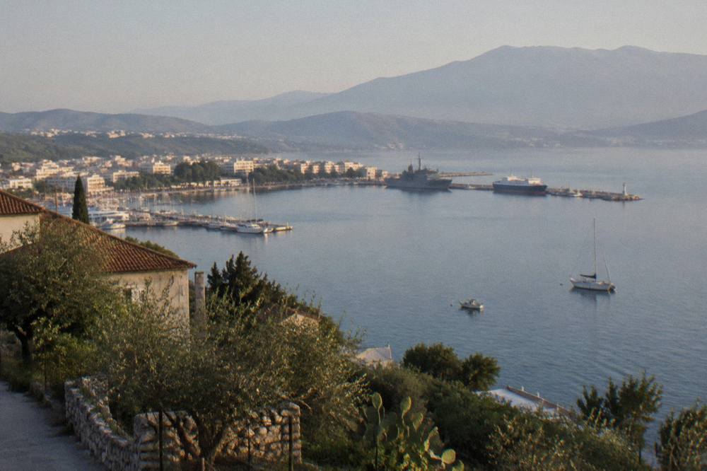
Souda is a port town on the southern shore of Souda Bay, roughly 7 km east of Chania Old Town, on the stretch of coast between the city and the Akrotiri peninsula, and it is the place where the island's sea link to Piraeus actually departs from. The bay itself is a deep natural inlet that opens north to the Cretan Sea, wide enough that the airport on the Akrotiri side sits about 14 km from the city centre. The two harbours do different jobs: the Venetian Harbour in the Old Town serves excursion boats, while the big ferries, naval traffic and cruise tenders all work out of Souda.
The municipality of Chania recorded 111,375 permanent residents at the 2021 census across an area of 356.12 km2, and Souda is one of the communities within it, functioning in practice as the port district of the wider city. Geographically it is defined by water on three sides of the view: the bay to the north, the Akrotiri peninsula wrapping the eastern arm, and the hills above the town rising toward the interior. The White Mountains (Lefka Ori) sit far to the south of the region as a whole, and on a clear day their outline closes the horizon behind the bay.
For orientation, it helps to place Souda against its neighbours. The table below sets out the geography the sources give, and it is worth checking before any booking, because a hotel "in Chania" can mean the Old Town, Souda itself, or somewhere on the road between them.
| Place | Direction from Souda | Role |
|---|---|---|
| Chania Old Town and Venetian Harbour | About 7 km west | Historic centre, excursion boats, restaurants |
| Chania International Airport (CHQ), Akrotiri peninsula | Across the bay, about 14 km from the city centre | Arrivals and departures for the region |
| Halepa | Between Souda and the Old Town | Consular-era residential quarter |
| Kissamos | Far to the west | Departure port for Balos and Gramvousa cruises |
| Souda Bay itself | Opens north | Deep natural inlet on the Cretan Sea |
The neighbouring quarters each have their own page: Halepa, the quiet quarter west of Souda, and the Akrotiri peninsula across the water, which holds the airport and several of the area's beaches.
What Arrives At Souda Port, And What Leaves From It?
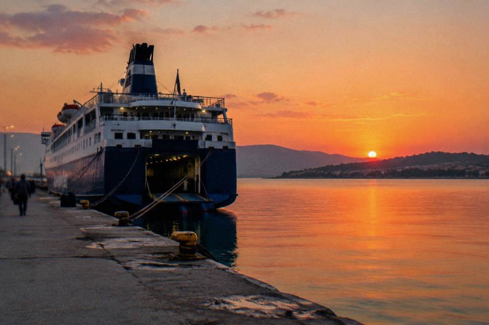
Souda port is the terminal for the Blue Star Ferries overnight service to Piraeus, which the operator's published timetable shows departing at about 21:30 with a crossing of about 9 hours 15 minutes, and it is also the port area used by naval and cruise traffic, while the Venetian Harbour handles only excursion boats. The ferry is the fixed fact of Souda: a daily overnight link to Athens that makes the district a genuine alternative to flying, with the timetable published as far as 31 October 2026 at the time of check. Fares move with the season and the operator, so the amount to pay is confirmed at booking rather than quoted here.
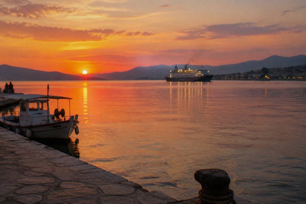
The ferry's practical rhythm shapes Souda's evenings. A 21:30 departure means passengers arrive through the late afternoon and evening, and the road from the Old Town carries a steady flow of cars and taxis in the hours before sailing. The crossing lands in Piraeus in the morning, which is why the service suits travellers connecting to Athens or onward flights rather than a day-return. In the other direction, the morning arrival into Souda puts a visitor about 7 km from the Old Town with the whole day in front of them.
Cruise traffic works differently, and this is where planning matters. Ships anchor in Souda Bay and tender passengers ashore rather than docking beside a terminal in the Old Town, so a cruise day in Chania begins with a boat ride to land and then a transfer into the city. The Chania cruise port day itinerary covers that sequence in detail, and the companion answer page on what to do in Souda Bay from a cruise ship sets out the realistic options for a short call.
| Service | From Souda port | Detail the operator publishes |
|---|---|---|
| Blue Star Ferries to Piraeus | Daily overnight | Departure about 21:30, crossing about 9 h 15 min |
| Excursion boats to nearby islands | Not from here | Depart from the Venetian Harbour, Old Town |
| Cruise tenders | Bay anchorage | Transfer by tender, then onward into Chania |
| Boats to Gavdos | Not from here | Run from Paleochora and Sougia in season |
The distinction in that table saves real confusion. Visitors who turn up at the Venetian Harbour expecting an Athens ferry, or at Souda expecting a sunset cruise, have both got the wrong address. For the full port-and-ferry picture, the wider coverage at Chania Crete Travel Guide includes a dedicated Piraeus crossing page, and the Venetian Harbour guide explains what the Old Town's own waterfront is actually for.
Given that Souda is a port and a bay, the tours that suit it best are the ones that use the water directly, with pickup included so the port-side location stops being a constraint.
What Can You Actually Do In And Around Souda Bay?
Souda Bay is a working body of water first and a leisure one second, but its shores hold quiet pebble beaches, a war cemetery on the flat ground by the water, and viewpoints over the bay from the hills above the port, and its calm, sheltered water is the reason dive and snorkel operators base trips in this corner of Chania. The shelter is real geography: the bay is enclosed by land on three sides, with the Akrotiri peninsula forming the eastern arm, which is why the navy and the ferries use it and why the water inside settles flat on days when the open coast to the west is chopped up by the summer north-westerly pattern.
The shoreline itself is low-key. The beaches near Souda are local, practical strips rather than resort sands, and visitors wanting the classic Chania beach day look west to Nea Chora and its long sandy stretch beside the Old Town, or further out to Agia Marina and Platanias. What Souda offers instead is scale: a wide bay, slow traffic, and water that is usually calm enough for a swim or a snorkel without the swell of the open coast.
That guided-snorkeling trip, which the listing shows with free pickup and stops suited to calm water, is the clearest fit for a stay based around Souda, since the operator's route and pickup arrangement remove the need to drive into the Old Town first. It sits in the site's wider boat coverage alongside the boat trips from Chania page, which compares the harbour, island and sunset options across the whole area.
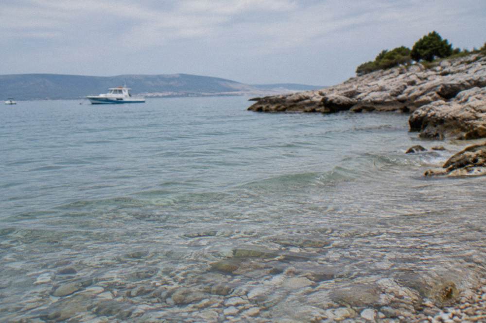
For divers, the same shelter that suits snorkeling suits beginners, and the bay's enclosed water is where a first dive can happen without open-sea conditions.
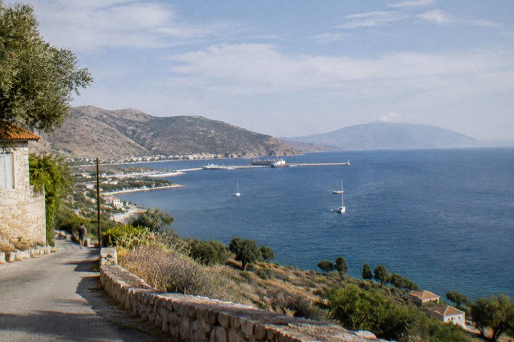
Away from the water, the hills above the port carry the road toward the interior and give the best physical sense of the bay's shape. Looking north from a height, the whole inlet reads at once: the quay, the anchorage, the Akrotiri shore and the opening to the Cretan Sea. The view is the area's quiet trump card, and it costs nothing but the drive up.
| Activity around the bay | Where it happens | What the sources support |
|---|---|---|
| Snorkeling and boat trips | Calm water inside the bay | Operators run guided trips with pickup, listings show routes |
| Beginner scuba | Sheltered bay sites | Listing shows a PADI instructor, beginner framing |
| Quiet pebble beaches | Shore near the port | Local strips, not resort sands |
| War cemetery | Flat ground near the water | A maintained Commonwealth war cemetery beside the bay |
| Viewpoints over the bay | Hills above the port | Road access, full view of the inlet |
One boundary worth naming: Souda is not the departure point for the famous west-coast boat days. The Balos and Gramvousa cruises leave from Kissamos, about an hour's drive further west, and the Balos lagoon and Gramvousa day trip page explains that route, including the EUR 1 Kissamos municipal fee collected on the boat ticket for over-13s.
How Do You Get Between Souda, The Airport And Chania Old Town?
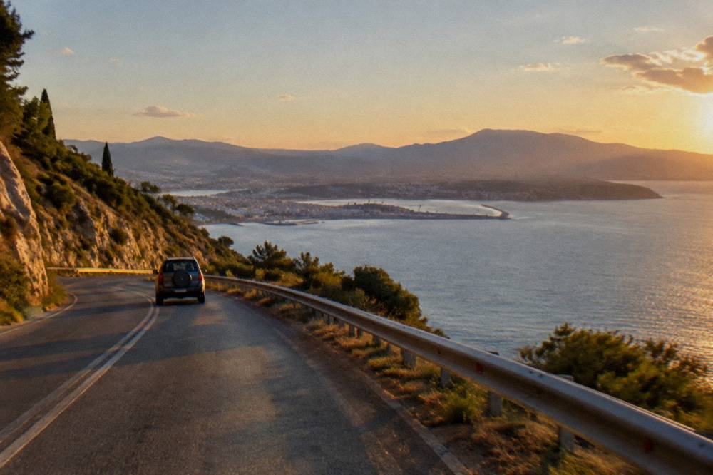
The three fixed points of the area are joined by road around the head of the bay: Souda port sits about 7 km east of the Old Town, Chania International Airport sits on the Akrotiri peninsula about 14 km from the city centre, and the airport's own site carries the current public bus and taxi information, while the long-distance KTEL station for the whole region is on Kydonias street in the city. The bus fare, the taxi fare and any shuttle price are not printed here because the airport's own page is where those current numbers belong, and fares of that kind move.
The airport's full name is Chania International Airport "Ioannis Daskalogiannis" (CHQ), operated by Fraport Greece, and its 3,992,149 passengers between January and October 2025 give a sense of the traffic level the road network handles. Arrivals land on the Akrotiri side of the bay, which means a visitor heading to Souda or the Old Town drives around the head of the inlet rather than across it; there is no bridge or tunnel, and there is no railway anywhere on Crete, so road and sea are the only options.
For travel beyond Chania, the KTEL long-distance buses run from the Kydonias street station to Heraklion, Rethymno, Kissamos, Paleochora, Omalos and, in summer, Elafonisi. A traveller based in Souda reaching that station first covers the 7 km into the city, which is why the district suits visitors with a car or a willingness to use the local bus spine. The getting around Chania page unpacks the options, and the KTEL bus guide covers the routes in detail.
| Journey | Distance or detail in the pack | Notes |
|---|---|---|
| Souda port to Old Town | About 7 km | Road around the bay's southern shore |
| Airport (CHQ) to city centre | About 14 km | Akrotiri peninsula, bus and taxi info on the airport site |
| Souda to Piraeus by ferry | About 9 h 15 min overnight | Departure about 21:30, operator timetable |
| Old Town to KTEL station | Kydonias street, in the city | Long-distance buses to the whole region |
| Kissamos port | West of Chania | Departure point for Balos cruises, not Souda |
What Is The Weather Like In Souda Across The Year?
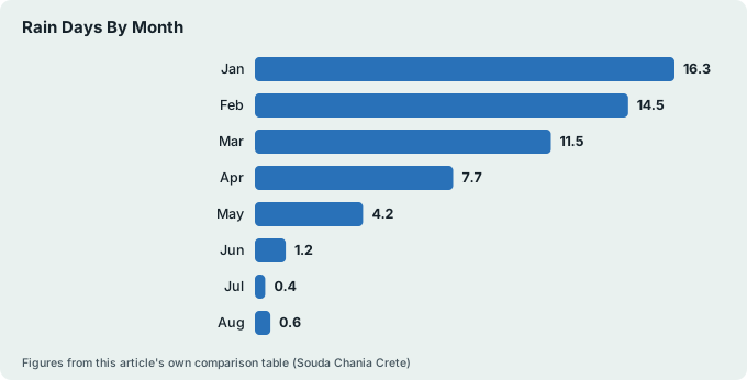
The climate figures for this corner of Chania come from the HNMS Chania Souda station, which sits at 148 m inland of Souda Bay and records monthly means for the period 1958 to 2010, showing a mean of 26.7 C in July against 11.0 C in January, and rainfall that runs from 129.5 mm in the wettest month, January, down to 1.0 mm in July. The station is the official source for the district and happens to sit in this very area, which makes its table unusually well matched to a page about Souda. The HNMS publishes no newer table, so the period stands as given.
What the numbers mean for planning is simple. May to September is dry, with 13.5 mm in May falling to 1.0 mm in July and 1.4 mm in August, and mean temperatures that climb from 20.2 C in May to the July peak. Rain starts to matter again from October, which records 67.7 mm, and the wet half of the year runs from November through March. Humidity in the table runs from 50 percent in July to 73 percent in January, and the prevailing wind is from the west, swinging north-west in July and August, the general summer pattern known as the meltemi.
| Month | Mean C | Rain mm | Rain days |
|---|---|---|---|
| Jan | 11.0 | 129.5 | 16.3 |
| Feb | 11.0 | 104.0 | 14.5 |
| Mar | 12.7 | 76.0 | 11.5 |
| Apr | 15.9 | 31.5 | 7.7 |
| May | 20.2 | 13.5 | 4.2 |
| Jun | 24.7 | 3.4 | 1.2 |
| Jul | 26.7 | 1.0 | 0.4 |
| Aug | 26.3 | 1.4 | 0.6 |
| Sep | 23.2 | 15.4 | 3.2 |
| Oct | 19.4 | 67.7 | 9.3 |
| Nov | 15.8 | 77.0 | 11.2 |
| Dec | 12.7 | 101.9 | 16.1 |
In that table, January is the wettest month and July the driest, statements that belong to the station record and to nothing else. No monthly sea-temperature normal exists for the bay in official data, so none is printed: a live reading is a live reading, and the desk does not convert one into a normal. The fuller seasonal picture, including which months suit which activities, sits on the best time to visit Chania page.
One Souda-specific point falls out of the wind data. The prevailing west and north-west summer wind blows straight into the open coast west of the city, while the bay's enclosed shape shelters its own water. On a windy July afternoon, that difference is the reason a snorkel trip inside the bay can run while a trip on the exposed north coast is uncomfortable.
Where Does Souda Fit In A Chania Itinerary?
Souda works best in one of three roles: as an arrival and departure point threaded around the overnight ferry, as a quiet, cheaper-feeling base for a longer stay that uses the coast road daily, or as a half-day stop on a loop between the Old Town, Halepa and the Akrotiri peninsula, and the right role depends on whether the trip is car-based or bus-based. A visitor without a car should weigh the 7 km distance to the Old Town seriously, because the evening restaurant and harbour life of Chania is the city's centre of gravity and the buses run on their own schedule, not the ferry's.
If a base by the port suits your stay, book a hotel room here.
For a short visit, the natural sequence is straightforward. A first day in the Old Town and around the Venetian Harbour, a second morning up to the viewpoints and shoreline of Souda and the Akrotiri peninsula, and a ferry evening that ends at the port quay. The ready-made versions of that shape are on the one day in Chania and two days in Chania pages, both of which can absorb a Souda segment without rewriting the plan.
For a longer stay, the district's practical strengths matter more than its charm. The road position puts the airport, the ferry, the city and the west-coast day trips all within reach, and the bay's calm water suits the water-based tours that operate here. A week built from Souda can combine the boat trips above with the classic west-coast days, of which the small-group two-beach option below is one.
The wider set of options, including gorge hikes and food tours that depart from the city rather than the bay, is laid out on the main things to do in Chania page, which is the root plan this area page plugs into.
| Trip length | Souda's role | Best fit |
|---|---|---|
| One day | Ferry arrival or departure only | Cruise or transit passengers |
| Two to three days | Half-day segment between Old Town and Akrotiri | First-time visitors |
| Five days or more | Full base, water tours from the bay | Car users, ferry arrivers |
| Cruise call | Tender stop, transfer into the Old Town | Shore-time planning |
A note on accommodation costs: no hotel rate is quoted anywhere on this page, and the climate crisis resilience fee that accommodation collects per room or apartment per night, with seasonal rates by category, is confirmed at booking rather than estimated here.
For travellers weighing Souda against the other quarters, the honest comparison is this. The Old Town and Splantzia and Topanas put the harbour and restaurants at the door at a price in atmosphere as much as money; Halepa offers a quieter residential walk into the city; Nea Chora adds the nearest sandy beach. Souda trades all of that for position on the port, the bay and the airport road, and for calm water on windy afternoons. A visitor whose trip starts or ends on the 21:30 ferry may find that trade exactly right.
Common Questions About Souda In Chania
How far is Souda from Chania Old Town?
Souda port is about 7 km east of the Old Town by road around the southern shore of the bay. The distance is short enough for a taxi or the local bus, but it is a real distance, not a walk, and an evening ferry departure means allowing travel time before the 21:30 sailing.
Do ferries to Athens leave from Souda or the Venetian Harbour?
They leave from Souda port. The Blue Star Ferries overnight service to Piraeus departs Souda at about 21:30 with a crossing of about 9 hours 15 minutes, per the operator's published timetable. The Venetian Harbour in the Old Town serves excursion boats only.
Where do cruise ships dock in Chania?
Cruise ships anchor in Souda Bay and bring passengers ashore by tender, then onward into Chania by transfer. The sequence and the realistic options for a short call are covered on the cruise port day page and the Souda Bay cruise answer page on this site.
Is Souda a good place to stay in Chania?
It suits travellers who want the port, the airport road and calm bay water within reach, and who are happy to travel the 7 km into the Old Town for evenings out. Visitors without a car who want harbour life at the door usually prefer the Old Town, Splantzia or Nea Chora.
Can you swim in Souda Bay?
Yes, on the quiet local shoreline near the port, and the bay's enclosed shape keeps the water calm when the open coast to the west is windy. The beaches here are practical strips rather than resort sands; the classic sandy beaches start at Nea Chora and continue west.
How far is Chania Airport from Souda?
Chania International Airport "Ioannis Daskalogiannis" (CHQ) sits on the Akrotiri peninsula across the bay, about 14 km from the city centre. Current public bus and taxi information for the airport is on the airport's own site, and no fare is quoted here.
Souda is the part of Chania that does the work, and it rewards the visitor who treats it as such: a ferry terminal with a timetable worth planning around, a sheltered bay with calm water and the tours that use it, and a road position that ties the airport, the city and the west coast into one loop. Build it into the plan for what it is, and the quiet stretches of shore and the view from the hills above the port become the parts of a Chania trip that no postcard ever promised.